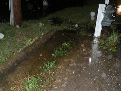
Please click on individual images to ENLARGE view of Soup Branch out of its banks near midnight on July 15, 2010, on South Duncan Avenue just north of W 12th Street intersection. Water comes off Pinnacle Prairie. Pinnacle Prairie's absorbent soil and tall grass and other vegetation help prevent water from rushing off and doing more damage downstream. High water also runs off World Peace Wetland Prairie but only in small amounts except during extremely heavy rain when the dark, rich soil is fully soaked and its holding capacity is exceeded. Much of the fastest flow comes from the acres of roofs and pavement in the Hill Place apartment complex and even from Rochier Hill by way of a pipe under the railroad and a pipe that routes a portion of the muddiest, silt-laden water underground directly to the north edge of WPWP.


No comments:
Post a Comment