Saturday, December 22, 2007

Workers try to keep Methodist mud out of Tanglewood Branch


PLEASE CLICK ON PHOTOS TO ENLARGE.

Central United Methodist Church


Religious leaders on Bush and global warming


Methodists discuss environmentalism

The good news is that the mud in Lafayette Street gets shoveled back onto the appropriate areas rather than washed into the storm drain by a water-spraying truck as seen in a previous post from a construction site near the UA campus that feeds Tanglewood Branch and eventually joins Spout Spring on the western edge of Walker Park and then flows into the Town Branch of the West Fork of the White River.

Friday, December 21, 2007

Saturday, Dec. 22, is the first day of winter 2007-08


PLEASE CLICK ON TOP PHOTO TO SEE SUNSET on Friday, Dec. 21, 2007, the final day of fall. Photo taken from Don Hoodenpyle's driveway at 11th Street and South Duncan Avenue looking southwest across a part of the Aspen Ridge site and across the World Peace Wetland Prairie and the Pinnacle Prairie to the Pinnacle Foods production facility, formerly owned by Campbell Soup.

PLEASE CLICK ON LOWER PHOTO OF TRAIN PASSING BETWEEN ASPEN RIDGE development site and the Summit development site on Rochier Hill south of Sixth Street in south Fayetteville, Arkansas, in the fog as viewed through a zoom lens on Dec. 21, 2007.

Saturday December 22, 2007, is first day of winter

Thursday, December 20, 2007

Street Jazz on public television in Fayettenam


Richard Drake on history of public television in Fayettenam


Richard Drake has a wonderful article on his blog linked above. I hope others who remember those times will add comments. I had not yet moved back to Fayetteville from Little Rock when the events he describes took place. I had been working at the Democrat and next at the Gazette till it closed and finally at the Log Cabin Democrat during 11 of those early open-channel years.

Maybe, if open channel hadn't gone through such a difficult period in Fayetteville, by now other cities in the state would have an open channel/CAT channel plus a government channel and an education channel.

We know that a great many dedicated and talented volunteers are needed to make that happen in any city, large or small.

Fayetteville is fortunate to have not only great volunteers but also generous donors to make the system work here.

So much of the abuse of power and corruption in government we read about in other cities and counties is avoided here because there is an amazing amount of public information actually available on PEG TV channels and in alternative newspapers.

This keeps the commercial media alert to details of government that might be overlooked otherwise. And it keeps public officials aware of their responsibility to all members of the public.

And the Web logs now on the Internet are contributing greatly to the same process of allowing everyone access to information and giving everyone a voice in government affairs.

Tuesday, December 18, 2007

Fayetteville's city council passes compromise budget 7-0


Arkansas Democrat-Gazette on Fayetteville budget


The Morning News' Fayetteville budget story


Thank goodness that Lioneld Jordan was able to get a budget passed Tuesday night. I suspect the aldermen who attended and voted and department heads and staff members all left the meeting a lot happier than they expected to be a couple of months ago.
Thanks to all who worked hard and must have experienced a year's worth of anxiety during the budget-negotiating period.

The good news was that the council wasn't stampeded into destroying any good programs or dumping any good employees. Some issues brought up in the negotiating process can now be worked out in a sane fashion.

Monday, December 17, 2007

Final UA poultry sale ends early as supplies run out.


The lady facing the camera was the penultimate customer taking home turkey breast meat at $1 per pound from the University of Arkansas' final poultry sale at its poultry-processing plant on the university's experimental farm.

Does anyone have any accurate information about the ending of years of a tradition?

Speculation among the huge crowd (many gave up standing in line and left as the supply of various products ran out) included talk of the expense to the UA and fear of being sued.
About three dozen were in line until it was announced that the turkey breasts were all gone!

Sued by retailers or producers of fowl meat? It would be unlikely for anyone to sue claiming to have been made ill by eating any of that food!

No limit meant many got plenty


PLEASE CLICK ON PHOTO TO ENLARGE.

On the final day of the University of Arkansas poultry-processing plant's sale, some people got all they asked for at bargain prices. This allowed to the sale to end at noon. Normal hours had been noon to 5 p.m. but a 9 a.m. opening was anounced and customers who didn't get the work were just pulling into the parking lot after the early bunch had left, many frustrated when the eggs, chicken and turkey were all gone!

Sunday was a nice day for counting birds

Please click on image to ENLARGE.

Joan Reynolds (from left), Doyle Crosswhite, Leigh Helms, Ellen Neaville and Cathy Ross did the annual bird count Sunday afternoon Dec. 16, 2007, on Pinnacle Prairie and World Peace Wetland Prairie as well as other south Fayetteville areas.

Saturday, December 15, 2007

Friday, December 14, 2007

Truck washing silt into N. Duncan Avenue; see where it goes in older posts below


PLEASE CLICK ON IMAGE TO ENLARGE.

Water taking silt into storm drain west side of N. Duncan Ave.


Tree roots cut on adjacent dug-out hillside


PLEASE CLICK ON PHOTOS TO ENLARGE.

Which company listed on the sign holds the stormwater permit?


Someone has to fill in the log each time it rains. That means someone has to inspect all stormwater controls daily. The ADEQ doesn't have enough inspectors to visit each site in Washington County once a year much less daily. And the city of Fayetteville has only one stormwater engineer with numerous sites in violation of stormwater regulations in the city. Basically, this is all on the honor system and complaint driven. Does anyone want to complain about this to a half-dozen overworked people? Maybe the contractor hasn't trained the workers on best-management practices but they get the blame?

Regardless, this not only affects fish and wildlife in the waterways, it affects the quality and price of drinking water of people in four counties of Northwest Arkansas.

North Duncan Avenue silt flows to Tanglewood Branch


PLEASE CLICK ON IMAGES TO ENLARGE.

Top photo shows tributary entering Tanglewood Branch from the west just south of Center Street. Both streams normally flow clear but bring pollution from Dickson Street and other areas north and west of the Fayetteville square.

Lower photo shows Tanglewood Branch bridge on West Prairie Avenue. The sign points out that the branch flows to the White River (by way of Spout Spring Branch and the main Town Branch) to our drinking-water source, Beaver Lake. Although these branches all originate from perpetually flowing springs, all receive dirty runoff from storm drains in the streets. Drop something in front of the post office or drop something on the sidewalk outside the Arvest bank and this is where it goes. Drop something on the sidewalk along Lafayette Street between College and Ole Main and this is where it goes.

Governor's Commission hires consultants

Read about the work of the nonprofit consulting firm hired to provide information for the Arkansas Governor's Commission on Global Warming to use to prepare its recommendations to the legislature at the following Web site link:


The Center for Climate Strategies


www.climatestrategies.us

Please read and sign the petition to the governor at the following link:

Petitions of interest

Wednesday, December 12, 2007

Dabney Brannon top official in Fayetteville office of Audubon Arkansas


PLEASE CLICK ON PHOTOS TO ENLARGE

Ken L. Smith and friend talk environmental conservation


PLEASE CLICK ON PHOTO TO ENLARGE

Ken L. Smith and friend discuss careers in environmental conservation.

Mary Smith, Audubon Arkansas' director of education, visits Fayetteville


Mary Miller Smith, Director of Education
Ms. Smith joined the Audubon Arkansas team in 2000, and works with students across Arkansas to connect schools and local communities with nature. One of her primary projects is The Common Ground Education Initiative, a partnership between Audubon Arkansas and the Winthrop Rockefeller Foundation, which focuses on project-based learning, field science, leadership, technology, and service learning. Prior to working in Arkansas, she worked in Washington, D.C., where she directed environmental education policy for the National Audubon Society and served as Special Assistant to the U.S. Secretary of Education. She has worked as an administrator and teacher for over 23 years in Arkansas schools, served as director of Wilderness Writers at the Ozark Natural Science Center and developed Farmstead, an educational restoration of an 1897 home and farm. She holds a B.A. and M.A. in English, and a M.Ed. in Gifted and Talented Education. Ms. Smith can be reached at marysmith@audubon.org.

Lauren Hawkins waits as Karen McSpadden of the Ozark Highlands Group of the Sierra Club checks the generous snack trays at the Audubon office


Please click on photos to enlarge.

Audubon Arkansas open house attracts area conservationists


Ken Smith, executive director of Audubon Arkansas (from left) listens to Dr. Stephan Pollard of the University of Arkansas while a friend talks with Lauren Hawkins, B.F.A. California College of the Arts, at the Northwest Arkansas Field Office of Audubon Arkansas in Fayetteville on December 11, 2007.

Audubon Arkansas open house Tuesday, Dec. 11, 2007, features two men named Ken Smith


Please click on images to enlarge.

Top photo

Kenneth L. Smith, the son of Elton V. and Carol Gibbs Smith, grew up in Hot Springs. In 1952 he enrolled at the University of Arkansas, majoring in mechanical engineering. During his freshman year he joined a university hiking group; while participating in this group he developed a great love for the Buffalo River country of northwest Arkansas.

Graduating in 1956, he worked for a paper company in Crossett, Arkansas, as an engineer. In 1961 he left Arkansas to attend graduate school in California. But rather than completing his graduate degree he accepted a position with the National Park Service; he later received a master of science degree in Natural Resources Administration from the University of Michigan. During his twelve years in the service he worked as a civil engineer in western parks and as a park planner in Washington, D.C.. In 1974 he left the service and returned to Fayetteville, where he became a freelance writer, photographer, and researcher.

During his years outside of Arkansas he retained his ties with environmentalists in the state, including members of the Ozark Society. In 1967 the society published his first book, The Buffalo River Country. It also published his second book in 1977, Illinois River. Smith’s third book, Sawmill: The Story of Cutting the Last Great Virgin Forest East of the Rockies, published in 1986 by the University of Arkansas Press, received the Virginia K. Ledbetter Prize in 1988 for the best nonfiction work on Arkansas.

The Ozark Society was founded in 1962 in response to the United States Army Corps of Engineers’ plans to dam the Buffalo River in order to create the Gilbert Reservoir. In the mid-1960s the Ozark Society mounted a campaign against the building of the Water Valley Dam on the Eleven Point River in northeastern Arkansas. In the early 1970s plans to build the Gillham Dam on the Cossatot River in southwestern Arkansas prompted the Ozark Society to take action. Because of the actions of the Ozark Society, these rivers were saved, and in 1972 the Buffalo River became the first river to be given the status of National River in the United States’ national park system.

Thanks to the University of Arkansas Web site for this information.
INFORMATION ABOUT THE Kenneth L. Smith COLLECTION of papers at the University of Arkansas library.

This collection contains material concerning the preservation of the Buffalo, Cossatot, and Eleven Point rivers put forth by the Ozark Society, the Arkansas Conservation Council, the Arkansas Nature Conservancy, and the Federated Garden Clubs of Arkansas. Other material concerns the founding of the Ozark Society. Several items in the collection were created by Evangeline Archer, secretary of the Ozark Society in the 1960s. The material also includes various publications dating from the 1960s and early 1970s that discuss the Buffalo River. Finally, the collection includes several short narratives probably written by Ozark Society president Neil Compton detailing hiking and canoeing outings.

The material in the collection include sannouncements, statements, correspondence, newspapers and clippings, magazine articles, booklets, flyers, and maps.

The Kenneth L. Smith Papers were donated to the University of Arkansas Libraries by Kenneth L. Smith on September 25, 1994.

Processed by Todd E. Lewis, Special Collections Division, University of Arkansas Libraries, Fayetteville, Arkansas, in August 2000.

Lower photo:
Left to right: Corey Holbert, Fayetteville Audubon staff member, Ken L. Smith, Kevin Pierson of LR office, Ken Smith of LR office, Dabney Brannon, Fayetteville office


Ken Smith, Executive Director of Arkansas Audubon (wearing blue shirt in lower photo)
Prior to joining Audubon in 2001, Mr. Smith served as Assistant Secretary for U.S. Fish Wildlife and Parks. Mr. Smith also served as Deputy Chief of Staff to President Bill Clinton and Secretary Bruce Babbitt in the U.S. Department of the Interior. As Assistant Secretary, Mr. Smith was responsible for developing policy of the National Park Service and the U.S. Fish and Wildlife Service. At the Interior Department, Mr. Smith was instrumental in establishing several new national wildlife refuges, one of which is the Pond Creek Bottoms National Wildlife Refuge in Southwest Arkansas. In 1997, Mr. Smith returned to Arkansas for a year where he served as Director of the Ozark Natural Science Center. From 1989 to 1993, Mr. Smith served Governors Bill Clinton and Jim Guy Tucker as Assistant for Natural and Cultural Resources. Earlier, Mr. Smith established the first office of the Nature Conservancy in Arkansas and served as Program Coordinator for the Natural Heritage Program. Mr. Smith holds a B.S. degree in Biology and Chemistry and an M.S. degree in Biology. He can be reached at kensmith@audubon.org.

Some of the other Audubon staff members pictured can be found at

Audubon Arkansas staff page

http://www.ar.audubon.org/AboutUs_staff.html

Tuesday, December 11, 2007

Fayetteville lady sits under umbrella across street from bus stop on Dec. 11, 2007


PLEASE CLICK ON IMAGE TO ENLARGE.

The bus stop might have been under the awning of the Divinity Hotel with nice benches by now if so many long-time Fayetteville residents hadn't said NO to giant buildings downtown. On the other hand, the lot where the bus stop is now might have been a mega hole in the ground like a similar project a few blocks to the southeast.
The lady said she was just grateful for the rain after many dry weeks.

Zed Johnson walks his dog and both appear to enjoy the rain


PLEASE CLICK on Image to enlarge.

Walker Park Master Plan homework assignment

Walker Park Neighborhood Master Plan
Community Presentation
December 11
6:30 p.m. to 8:30 p.m.

To all participants and stakeholders, We will hold the final community presentation for the Walker Park Neighborhood Master Plan on Tuesday, December 11. Please join us in celebrating the conclusion of this successful planning process and come hear about the ideas generated by the community and plans for implementation. The presentation will begin at 6:30 p.m. at the Fayetteville Senior Center.

Please visit the City Plan 2025 website to view the draft vision document and illustrative plan. Or download the documents from the links below.

Walker Park Neighborhood Master Plan - DRAFT (5.8MB PDF)

Walker Park Neighborhood Illustrative Plan (1.3MB PDF)

Contact Karen Minkel at 575-8271 with any questions.

Best, Karen Minkel

Karen Minkel
Senior Long Range Planner
City of Fayetteville
(479) 575-8271

PLEASE SCROLL DOWN to aubunique comments on a news story about the plan.

Monday, December 10, 2007

Petition against coal-fired power plant in Arkansas


Petition to Arkansas' governor

Don't miss Walker Park neighborhood summary of proposals Tuesday, Dec. 11, 2007

The majority of people who live in the Walker Park neighborhood didn't attend the charrettes (the intense design and planning meetings the city's planning staff worked so hard to coordinate).
That is a shame. Probably, a majority don't know what occurred in the meetings. The few who attended offered a lot of suggestions and maybe some of their ideas will begin to become reality.

Their ideas are mostly good, although some would be incredibly expensive to turn into reality and even the best will take time and money to take shape.

Some ideas are bad ideas from the point of view of many.

Strangely, some ideas that go against the city's newly adopted sustainability effort are based on FEAR. And that is sad and disappointing to at least a few of us who truly love and appreciate the park and the surrounding neighborhood and the relatively inexpensive services provided in the area.

I'll leave it to others to explain what might be the source of fear in the discussion of possible future plans. Let's sample a few excerpts and comment, preferably after you read the full newspaper story.
The full story in the Northwest Arkansas Times of Monday, Dec. 10, 2007, is available at:

Northwest Arkansas Times story


http://www.nwanews.com/nwat/News/60100
Let's sample a few excerpts and comment, preferably after you read the full newspaper story.
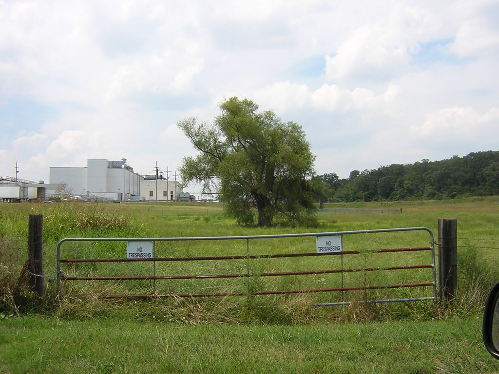
Walker Park, at 64 acres, is one of the largest in the city, excepting the parks associated with lakes. But there are sections that aren't used at all because of brush or people not feeling safe, said Karen Minkel, senior long-range planner.
COMMENT: "Brush" or understory vegetation as it is known when standing in conjunction with mature trees is extraordinarily important in our parks because it is being removed from private yards and, in much larger portions, from every new construction site in the city.
Removing vegetation is among the greatest threats to our climate. Vegetation breathes carbon dioxide and exhales oxygen.
Take a look at the Keeling chart at the following link and see just how radically the earth's atmosphere has changed in recent decades:
Carbon Caps Task Force blogspot

Giant coal-fired plants that produce electricity are among the worst causes. But anything that burns contributes to the problem as fire depends on oxygen and releases carbon into the air.
Song birds, especially the ones most people love to see and feed, cannot live without nesting sites. And understory vegetation (brush and low-growing trees and vines) provides nesting and roosting sites for them. Thickets not easily entered by human beings are best. But any patch of brush is important. And those same plants offer food not only to birds but to numerous other species as well.
If you attend Tuesday's (Dec. 11, 2007) open house at the Arkansas Audubon office near Fayetteville's downtown square, ask to see one of their backyard wildlife brochures. I hope they have plenty to give away. But a quick read will offer tips not only for individuals but even for people talking about managing parks.
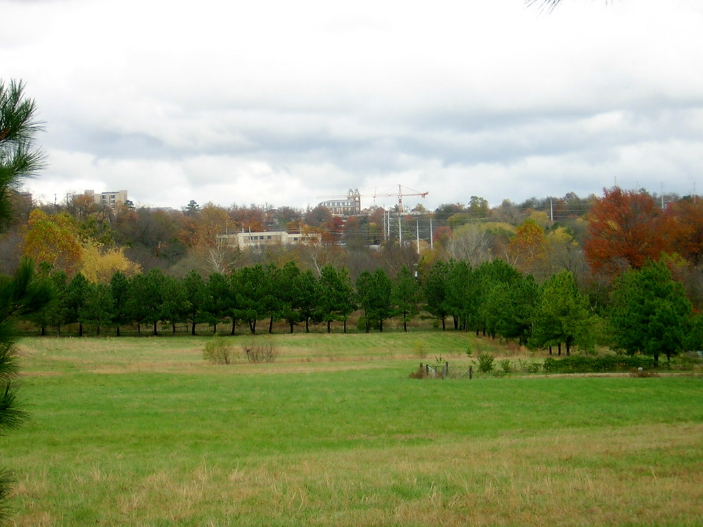
Walker Park has a magnificent stand of hardwood timber on its eastern acreage. Whether I choose to stop and walk through those woods are not, I USE them every day when I drive by.
Trees, brush, flowering plants and tall grass comfort me in our rapidly changing town. There was a time when Walker Park's wooded area and its riparian zone (streamside greenspace) offered unmitigated comfort, because I believed it would never change.
For several years, changes have slowly come. New parking lots have taken out trees and even the very soil on which they depended. The wonderful Senior Activity Center replaced a beautiful portion. The park for skateboarding and such buried a lot of wonderful soil and grass under pavement.
The paved "trail" along the west side was built in the riparian zone of Spout Spring Branch, which brings water from as far away as the east side of Fayetteville High School's campus to Maple and Lafayette and Dickson streets and the square all the way up to N. College Avenue through its tributary known as Tanglewood Branch in addition to its own water from the western and southwestern slopes of Mount Sequoyah and the beloved Spout Spring near Center Street.
Fayetteville's City Council recently passed a resolution supporting the protection of riparian zones, so surely the trail planners will work to see that soil won't be removed or buried under red dirt and asphalt or trees and "brush" removed from riparian areas as future trail routes are selected. A treeless trail isn't pleasant to use in summer or winter. Well-vegetated stream corridors offer not only shade in summer but serve as shelter belts to weaken the wind in winter. And paving done near stream banks inevitably results in increased erosion.

The Times story continues: The proposal would add paved and nature trails in the northeast quadrant, which would open the park to people who live north of Sixth Street and make it more usable and connected to the neighborhood and the city.
COMMENT: The theory is good and can be carried out without damaging the forest and contributing to global warming by creating paths without any addition of impermeable material. There is nothing about many miles of the city's "trails" that attract people wanting a nature walk. One can pass along the edge of the wooded area and feel "safe" at Sixth and at Thirteenth Streets. And near the halfway mark, there is a wide, meandering paved trail from the publicly accessible Senior Center acreage facing S. College and westward to the open areas of the park.
A small entryway at the northwest corner of Walker Park would be nice, but a sign and a gently blazed trail should be the route into the park's only natural portion. That would be in keeping with our sustainability goals and keep the aborbent soil to help meet the stormwater-regulation goals.
The Times story continues: Adding lighting and benches to the trail along the creek (Spout Spring Branch) and the park's western border, a children's play area with a water feature, and extending the Frisco Trail from downtown are other elements of the vision.
COMMENT: Unobtrusive benches would be nice. Lighting would be OK if solar powered lights are provided. The city already is gradually installing street lights and traffic-signal lights that use less electricity than the old ones did, I have heard. But, again, bright lights should not be placed in a way that interferes with the normal habits of wildlife in the area.
The Times story continues: "What we heard a lot was that people wanted to have more activity in the park, in that sometimes if they were on a trail and there wasn't a baseball game or something going on, they felt like they were by themselves," said Tim Conklin, the city's planning and development-management director. "If there's no one around, you don't have that sense of safety. If there's lots of people around, you feel safe and comfortable. We heard that from a lot of people."
In contrast, a lot of people go to parks and seek out places to be alone. Many park visitors are totally focused on themselves and their activity. Noise and activity of the birds and squirrels and such are plenty for them.
I play softball in Walker Park on many Sunday afternoons with others who enjoy an informal game with men, women and children participating in all seasons of the year. I sometimes play basketball at either the southeast corner of the park or the northwest corner and would like more courts because on many weekends and summer evenings people stand or sit and wait to play. At least one of the baseball fields should have deeper fences to accommodate those all-age softball games. I have fished in Spout Spring Branch and several times just waded the creek to photograph the trees, vines, rocks, birds and other wildlife.
Being an urban stream, of course, Spout Spring and its tributaries such as Tanglewood Branch are constantly polluted by street runoff and littered by debris. Audubon and the boy scouts and other volunteers haven't done a cleanup in about two years. Naturally, the next significant rain washes in so much new debris that evidence of the cleanups is always quickly wiped out.
One shocking photo opportunity I have not checked on lately is between South School Avenue and Walker Park where a large sewer line sags badly as it crosses Tanglewood Branch. Former Alderman Swifty Reynolds walked there with me to see it about three years ago. Maybe he reported it to the water and sewer officials and got it fixed. Maybe one day soon I'll go back to see it.
But back to the Times story:
Continuing Ninth and 13th streets to South School Avenue would create a western entrance to the park, connecting the neighborhood to the commercial district.
WHOA!!!!!
A narrow walking bridge would be appropriate somewhere outside the riparian zone of Tanglewood Branch starting somewhere near Ninth Street and South School Avenue.
But opening those streets shouldn't be in the plan. Construction of bridges for even the narrowest roadways always takes out a huge chunk of riparian vegetation. The streets would also take some acreage out of the soccer fields because it is unlikely that the new facility for skate boarding would be removed. And don't forget the beautiful, mostly wooded wetland on private property in back of the mostly commercial property facing South College Avenue.
It should not take more than one of the following to veto that part of the plan: the tree administrator, the watershed/stormwater engineer or the sustainability coordinator.
Fortunately, there are far too many real infrastructure needs at a time of revenue shortage for that idea to get priority.
There are many wonderful ideas in the plan and a few others that appear absurd or extremely disruptive to current residents and businesses.
I hope plenty of people show up, especially people who skipped the charrettes. It is not too late to offer more positive suggestions and to bring up questions about some already on the board.
The vision for the Walker Park neighborhood will be shared with the public from 6:30 to 8 p.m. Tuesday at the Fayetteville Senior Center at 945 S. College Ave. There is plenty of room for several hundred people to attend for at least part of that time. And the planners WILL listen. It's everyone's plan.
By the way, the Audubon Arkansas' open house runs from 3 p.m. to 7 p.m. with only a 30-minute overlap. There is no excuse not to do both. The Audubon office is at 34 East Center Street, less than a half block west of College Avenue and a block east of the square. The senior center is on South College only about the equivalent of 11 blocks south of the Audubon office.
As you travel between the too places, imagine what the construction work to make some of the proposals into reality would actually be like if you were a person living, working or traveling through the area each day.
The Fayetteville City Council meets in agenda session at 4:30 p.m. but you can watch the video of that on the government channel, Cox Cable 16, on Wednesday morning. The agenda should be online at accessfayetteville.org to look at. I didn't have time to search for it tonight. Maybe it is on Jeff Erf's alternative city site.

Please attend Audubon Arkansas open house Dec. 11

Friday, December 7, 2007

Aspen Ridge's new owners approach park board Dec. 3, 2007

Copy and paste the following: http://www.accessfayetteville.org/government/parks_and_recreation/documents/agenda/PRAB_December_2007_Agenda_and_Packet_(1_of_4).pdf

or click on the following link for an

UPDATE on Aspen Ridge Park dedication

Thursday, December 6, 2007

Old topographical map by US Geological survey of Town Branch neighborhood shows Town Branch of the West Fork of the White River


There is a bit of misinformation on the segment of the CAST system that describes the Town Branch of the West Fork of the White River.
PLEASE CLICK ON MAP TO ENLARGE

Historically, the Town Branch of the West Fork of the White River is the stream that leaves the UA campus under Sixth Street with water draining much of the UA campus and the Fayetteville High School campus.

If you look at older USGS maps you will see the word Town on the portion of the stream running southeast between S. Ellis Ave. and S. Van Buren Ave.

At the time the stream was named, the UA campus was the extreme western edge of the "town" of Fayetteville. And there has been less dredging and filling of that portion, except at its confluence with a branch from the west, which is properly called the west arm of the Town Branch or even Wal-Mart Branch or I-540 Branch or Farmington Branch.

College Branch was the name given to the portion draining Markham Hill by city mappers in the 1990s and Mullins Creek was the name given since 2000 by the UA to the central part that runs from the ridge at Cleveland Street and under the the athletic facilities. Neither of these names should be applied to the part that flows under Sixth Street and the railroad and then through the Town Branch neighborhood.

The College Branch and the Mullins Creek join where they flow each from its on giant culvert from beneath Leroy Pond Street or Drive and through the old grounds of Carlson Terrace. That is where the combined flow should actually regain its historical name of Town Branch of the West Fork of the White River.

The Town Branch flows all the way to the West Fork. It is joined by the combined flow of the Cato Springs Branch and the west arm of the Town Branch near the Salvation Army Store south of 15th Street and west of School Avenue. From aerial photos one may recognize that the formerly meandering streams have been modified in recent decades. A lot of dredging was done on the west arm and the lower parts of the Cato Springs Branch. The straightening and widening makes the combined flow of those appear larger than that from the original Town Branch from the north.

But the mapmakers used the name Town Branch only for the parts of the stream that actually drained the town of Fayetteville. Names such as Tanglewood Branch and Spout Spring Branch now identify two tributaries that flow from the east of the UA to the Town Branch.

Another significant point is that the word "creek" is not properly added after the word "branch." The word "branch" is simply the name of a small stream that contributes to a larger stream, which in turn may be itself called a "creek" or "fork" or "bayou" or "river."

Wednesday, December 5, 2007

National Wildlife Federation supports energy bill in Congress


PLEASE CLICK ON PHOTO TO ENLARGE mallards at Baum Stadium detention pond in Fayetteville, Arkansas

The 2007 Energy Bill has been one long and bumpy ride.It's down to this...
The final energy bill will be voted on in the House of Representatives THIS WEEK, followed by a Senate vote next week.
The U.S. House is voting THIS WEEK on a final energy bill.
Make sure your representative votes for wildlife and passes a strong bill!
With global warming threatening 30-40 percent of wildlife species, Congress MUST pass an energy bill in 2007 to lay the groundwork for strong global warming legislation in 2008 and beyond.
Let your representative know: "Americans need an Energy Bill with..."
Protections for wildlife and public lands from oil and gas development.
A Renewable Electricity Standard of at least 15 percent by 2020.
A fuel economy standard of at least 35 mpg by 2020.
We believe a bill with these three things can pass in the House and Senate, making a terrific down payment on an upcoming global warming bill!

Speak up today and help get the energy bill to the finish line:
http://online.nwf.org/finishline

ENERGY Finish line

Kristin Johnson
Grassroots Mobilization Coordinator
National Wildlife Federation
alerts@nwf.org
© 2007 National Wildlife Federation.

Monday, December 3, 2007

Suggested questions to be answered by planners

Everytime I watch the architectural-standards committee or the ordinance-review committee of the Fayetteville City Council on Government Channel 16, the same thoughts come up.

The committee members are not asking all the important questions while they have a chance. Maybe that is because the planners don't bring up all the important issues and developers and builders never mention them.

Some things I wish the developers and planners could tell us upfront and buyers and renters could be certain of before committing:

PRACTICALITY
How long will this building or group of houses last?

Will they be there longer than buildings that had stood there before and were removed to make space for the new development?

SAFETY
Will they withstand a tornado or an earthquake? Will at least some fully contained rooms survive such a disaster?

Are they safe from flooding from adjacent property even if 10 times the recorded previous maximum rain should occur?

Are the various types of structural material resistant enough to fire to make sure no can ever die from smoke or flame in the buildings?

Are there adequate provisions being made for facilitating changes in technology regardless of whether new pipes, cables or wires, etc., will be needed 50 years in the future? Major renovation should not be required to in order to add features.

SUSTAINABILITY
Are the buildings going to be easily adapted to the use of solar panels or harbor their own windmills for power production?

Are the buildings going to accomodate a green (vegetated) roof?

Are landscaping plans going to utilize raingardens and rain-retention containers to provide for pets and native plants?

Are site-preparation plans going to reduce removal or burying of existing soil and trees and vegetation?

Are whole developmentments going to be compatible with surrounding existing neighborhoods?

Are the setbacks going to be adequate to allow privacy and access?

After those questions are answered positively, then the superficial things can be discussed:


How will it look?
Will there be enough diversity in multi-unit developments to allow people to go straight home without a moment's hesitation?
The list of standard questions is already on record.

Here is a not-so-radical and certainly not new question that would require some changes in state law:

Can the bank finance future property tax as well as the annual property tax? While no firm figure can be determined, some sort of estimate of projected real-estate tax could be made on the assumption that a future-tax reserve fund could be maintained for all identities that currently benefit from property tax so that a person could pay his future tax while paying for the property. The potential interest on such a fund possibly would amount to more than the actual future tax growth because raising tax rates is always controversial and limited by law and the will of the people.
Under the current system, a person making payments on a standard mortgage can't lose his property to a tax lien. However, a person who has paid off his mortgage immediately is at risk of failing to pay and having a lien placed on his property. Those who pay cash should be required to pay into the same fund at the same rate but with a discount if they pay the total upfront. Such a system could eliminate the annual race by the moneyed class to take away property being auctioned for failure to pay property taxes, along with an expensive bureacratic nightmare.
Might be nice to actually own something outright for the rest of one's life and to be assured that heirs can't lose it for failure to pay taxes later.

Protecting the property in perpetuity might be impossible, but a 100-year term would be nice for the heirs, who might be much more interested in maintaining inherited property if it didn't also require an additional tax burden.

Keeling Curve plays big role in documenting cause of climate change

Consistent growth in CO2 pollution has been documented for fifty years by the

The Keeling Curve


TIMELINE: carbon monitoring

1957: Charles David Keeling starts work monitoring CO2 at the South Pole and Mauna Loa Observatory, Hawaii

1958: Keeling starts first direct continuous atmospheric measurements of CO2

Early 1970s: Noaa, the US federal agency, starts monitoring CO2 worldwide

1995-2003: Noaa's Earth System Research Laboratory (ESRL) at Boulder, Colorado, develops and maintains the world's standard references for CO2 and other greenhouse gases

For more information about the problem of CO2 increases and potential solutions, please visit Website of the
Carbon Caps Task Force at the following link:
Carbon Caps Task Force blogspot


Many items there will be submitted by members of the governor's commission on global warming, particularly by Robert McAfee and Art Hobson.

Friday, November 30, 2007

Hubert Ferguson of Ponca and Tim Wargo of Big Island, Arkansas, in 1989 or '90


PLEASE CLICK ON PHOTO TO ENLARGE

Ferguson was a member of the Big Island Hunting Club at that time and, like Wayne Hampton, was extremely fearful that the Corps of Engineers lock and dam near the mouth of the White River would destroy a great deal of wildlife habitat between the White and Arkansas and Mississippi rivers. Hampton had a big metal cabin boat that would take several people at once down to the island.

Time has proven they were correct. And the project is not really complete yet. But the federal money keeps rolling down the river!

Thursday, November 29, 2007

Old friend gone but his concern for lower White River remains


PLEASE CLICK ON IMAGE TO VIEW photo of Wayne Hampton at Big Island and to read the column from 1990.


Articles recently in newspapers and magazines have reminded us of the disastrous Army Corps of Engineers projects that threaten the lower White River's habitat and the wooded wetland along its shores — land that offers some of the world's most important and rare wildlife habitat as well as an area that sequesters an enormous amount of CO2 in the mid-south region.

Congress continues to provide money for the lock and dam where the combined flow of the White and Arkansas rivers enters the MIssissippi River at Big Island, which is the subject of this 17-year-old column. For more about the lower White River and this project, get a copy of The Last River, which was published by the University of Arkansas Press.

A second project is abuilding upstream. It willl pump water from the lower White River to agricultural land.

Wayne Hampton was the second-generation owner of a 4,000-acre Grand Prairie farm. His father had begun building reservoirs on his own land to collect rainwater to irrigate his own crops. Wayne continued that effort and spoke valiantly of the need for every owner of large tracts of land in the Mississippi River Delta and especially on Arkansas' Grand Prairie to conserve water, to keep it where it fell, and use it rather than asking the government to bring water from the environmentally sensitive White River to meet the need for agricultural irrigation.
Even today, Rick Hampton maintains his father's tradition and uses water over and over, irrigating and then flooding a big stand of hardwood timber and selected fields for waterfowl and then pumping the water back to the storage ponds if winter and spring rain doesn't refill the on-farm reservoirs.

Sunday, November 25, 2007

Dr. Jocelyn Elders to speak Wednesday Nov. 28

WEDNESDAY 28TH Planned Parenthood will celebrate 26 years of being in Northwest Arkansas. The event will be from 5:30 to 7 P.M. at the Unitarian Church at 901 Cleveland in Fayetteville. Dr. Jocelyn Elders will be their guest speaker.

Saturday, November 24, 2007

Sept. 2, 2004, view of Pinnacle Prairie from 12th Street turnaround

Entry to Pinnacle Prairie from 12th Street on Sept. 2, 2004

Please click on photo for full view and then use the all-sizes magnifying tool above the photo to enlarge.
Please click on
Set of photos of Pinnacle Prairie
for more photos of the area or copy link below to address bar.
www.flickr.com/photos/7295307@N02/sets/72157601412198234/

Wednesday, November 21, 2007

House at 1135 Ellis falls down after months of preparation

http://townbranchneighborhood.blogspot.com

See photo of neatly dropped affordable house at
Town Branch Neighborhood

Arkansas public service commission approves coal-fired generating plant


Texarkana coal-fired plant approved by Arkansas PSC


Please click on image to enlarge.

Would this plant have been in full flower on Nov. 21, 2007, on Pinnacle Prairie near World Peace Wetland Prairie in Fayetteville, Arkansas without the effect of global warming?

I would appreciate an honest answer with documentation of the plant's common or scientific name and its normal time to bloom. Of course, comments based on opinion are also welcome!

Pinnacle Prairie viewed from 15th Street on Nov. 21, 2007


Please click on image 1791 to enlarge and use the all-sizes magnifying tool above the photo to see Pinnacle Prairie in south Fayetteville, Arkansas. The truck-parking lot at left was built since the Nov. 2004 photo was made and a wide base for a new portion of Brooks Avenue was created from the now-cleared Aspen Ridge site in the background to its intersection with the westward extension of 12th St. The old 12th street turnaround is represented in the photo by the long-open gate and the turnaround was dug out, a large culvert was added across it and, on Nov. 20, 2007, red dirt was dumped and spread in the east end where the turnaround formerly connected to 12th St.
Image 1791 vu N pinn prairie

Tuesday, November 20, 2007

Pinnacle Prairie from the south on Nov. 18, 2004, with Ole Main in the background

2061oleMainFrSo

PLEASE CLICK TO ENLARGE image 2061, oleMainFrSo, which shows Pinnacle Prairie from the south with Ole Main and the University of Arkansas campus in the background. The land to the right of the row of pines became known as World Peace Wetland Prairie on Earth Day 2005 and is a nature park of the city of Fayetteville, Arkansas. The land behind the row of pines in the center of the photo became known as phase two of Aspen Ridge. An old plat was still on record at the county archive, so Fayetteville was obliged to allow the developers of Aspen Ridge to dig out a route for an unbuilt platted portion of Brooks Avenue through the pines and southward past the small willows in the center of the photo. That street base was also dug out to the right to connect to 12th Street, represented in the photo by the fence posts at the center right of the photo. At the time the photo was made, Pinnacle Prairie had all been mowed down. Native plants were suppressed by the frequent mowing at that time.

Earlier photos on this blogspot show recent photos of Pinnacle Prairie and the dug-out roadbed created by the developers of Aspen Ridge.

Fayetteville Council to consider budget & proposed cuts for coming year

City Council plans to discuss
Proposed city budget
at its regular meeting set to begin at 6 p.m. today in Room 219 of the Fayetteville City Administration Building.

Views of 12th Street on Nov. 1 and Nov. 20, 2007


The red dirt was filled in to make the end of the 12th Street safer, Hank Broyles said on Tuesay morning. It is unclear that city officials actually understood what was planned.

The leopard frogs, burrowing crayfish and birds and wildlife that had been using the water hole during the weeks without significant rain won't like it. However, maybe some people who worried about possible mosquitoes during summer and some who feared a car would run off the end of the street into the proposed street extension may feel safer. The red dirt in the street and runoff from the red dirt to the adjacent wetland and small branch that flows east to Town Branch, of course, is something we hope doesn't occur.

We understand that Hank is trying to do the right things to solve some of the problems that have affected the neighbors and the environment since 2005.

Who authorized this?


Red dirt being dumped at the west end of 12th Street just west of S. Duncan Avenue.

PLEASE CLICK ON PHOTO TO ENLARGE and see tracks of deer, raccoon and assorted birds and other wildlife
Red dirt being dumped into extension of 12th St. to fill road base. The culvert is being buried without having been approved by the city and the red dirt will erode into adjacent Pinnacle Prairie and flow down 12th St. to S. Duncan in case of significant rain.
Who authorized this? Workers said they are doing it at the behest of Appian builders, which is associated with Hank Broyles and John Nock in the planning of the proposed PZD on top of Rochier Heights.

Monday, November 19, 2007

Coody calls it quits, The Morning News reports


PLEASE CLICK ON PHOTO TO ENLARGE


Northwest Arkansas Times


Morning News story:
Coody calls it quits


NWA TIMES report: Will not be a candidate for mayor next year,
Mayor Coody

says.

NWA Times reports fire marshall issues red-flag fire warning

Washington County under "red flag" fire warning
Monday, November 19, 2007 | The Washington County Fire Marshal's office on Monday placed the county under a red flag fire warning, meaning the fire threat level is high. With high winds and dry conditions, fires will start and spread rapidly. All fires will be erratic, easy to spread and difficult to control. Outdoor burning should be avoided if at all possible, according to the fire marshal. From Northwest Arkansas Times


Why not just ban burning? Is there any possible reason for outdoor burning today other than to endanger people and other living things?

Dan Coody announces he will not run for Mayor next year

Will not be a candidate for mayor next year,
Mayor Coody

says.

Sunday, November 18, 2007

Aspen Ridge plans outlined in Arkansas Democrat-Gazette story linked below


PLEASE CLICK ON PHOTO TO ENLARGE
Phase two of the Aspen Ridge project is in the background (north) behind the row of pine trees.
Brooks Bayou is one of the few printable names applied by neighbors to the strip of land dug through the property of Pinnacle Foods (the current owners of the old Campbell Soup facility) for a new portion of Brooks Avenue to reach south to a new outlet to 12th Street and from there east to South Duncan Avenue.
Contractors stopped working on the extension of Brooks Avenue in July 2006. Erosion of dirt from the top of a storm sewer is visible along the right edge of the photo and native wetland plants have grown up in the street bed, which was holding water on Saturday Nov. 17, 2007, despite several weeks with no measurable precipitation.
The Pinnacle Prairie, a name lovingly applied to the wetland between World Peace Wetland Prairie about 200 feet to the east of the photo (out of photo to the right) and Rochier Hill to the northwest (far left in photo), is an extraordinarily rare wetland area with seep springs that support numerous species of native tall grass, Illinois bundle grass, button bushes such as seen in Lake Conway, milkweed that supports many species of pollinators but especially the caterpillars of the monarch butterfly as well as the fall generation of monarchs that migrate from New England and Canada all the way to Mexico, plus such striking plants as the rattlesnake master in years when the Pinnacle Prairie is not mowed frequently.
After two summers of not being mowed, the eastern 2 acres of Pinnacle Prairie, which shares a boundary with World Peace Wetland Prairie, has brought forth magnificent specimens of these and other important native wetland prairie plants.
The problem with the extension of Brooks as it is now configured is that water is prevented from flowing underground and on the surface from the west and northwest across Pinnacle Prairie to support native vegetation to the east. For the health of WPWP and of the portion of Pinnacle Prairie at right in the photo, a series of small culverts must be constructed across the street bed to allow the water to flow where it always did in the past and where it is still needed. No more water is needed to flow and potentially flood the outlet from Pinnacle Prairie to the Town Branch. Far too many pieces of property already are at risk of flooding downstream as a result of the filling of wetland upstream along the Town Branch.
The future

Aspen Ridge sale

still on city radar.

Ban burning today!

Area needs
Burn ban

now!

Why wait until something really bad happens?

There is no excuse for 99 percent of the outdoor burning people do.

Beaver Lake could be like Lake Lanier in coming dry years

Northwest Arkansas continues to bring more and more homes onto the Beaver Lake watersupply. But the next big drought could be here instead of in the Georgia area. With wells and springs being capped or paved over and pollution of the underground water and siltation of the streams, how would we cope with the problem? Beaver Lake could suffer the same fate as
Lake Lanier

Saturday, November 17, 2007

Presidential candidates speak on global warming at 4:10 p.m. TODAY, Nov. 17, 2007

Click on

Candidates speak


to hear what candidates for president have to say about global warming.

This Saturday, November 17, presidential candidates will gather in Los Angeles for the first ever Presidential Forum on Global Warming and America's Energy Future. The event will be a critical opportunity to hear from the candidates on their positions and to spotlight the climate crisis as one of the most important leadership challenges facing the next president.
> Thanks to you and thousands of other activists, energy and global warming are taking center stage in the 2008 campaign. This forum is an opportunity for you to hear from the candidates directly about where they stand on these issues you care so much about.
> More than a thousand people will fill the theater to watch the event, and due to overwhelming interest, we are giving everyone the chance to tune in!
> You can watch the live webcast at www.grist.org/webcast.
> The event, which is sponsored by Grist and Living on Earth, will start this Saturday at 5:10 EST (2:10 PST) with remarks from Laurie David and a welcome address from Mayor Antonio Villaraigosa. Each of the candidates will then get 30 minutes on stage to talk about their vision for solving our energy problems and answer questions on their policies.
> Here's the schedule on Saturday, November 17:
Congressman Dennis Kucinich
Senator Hillary Clinton
Senator John Edwards
> League of Conservation Voters' Education Fund has been a key partner in helping pull this important event together and we wanted to make sure that all of you had the opportunity to tune in!
> Be sure to visit www.grist.org/webcast this Saturday to watch the presidential forum on energy and global warming, and please forward this to your friends and family so they can see where the candidates stand on the most critical challenges facing our nation and the world today.
> Sincerely,
> Gene Karpinski
> President
> League of Conservation Voters Education Fund

Friday, November 16, 2007

Swallowtail butterfly on Verbesina virginica on Sept. 10, 2007


PLEASE click on photos to enlarge.

Verbesina virginica is called white crownbeard and frost weed


PLEASE CLICK on photo to ENLARGE
Verbesina virginica L.
Frost Weed, Virginia Crownbeard, White crownbeard
Asteraceae (Aster Family)
USDA Symbol: VEVI3
USDA Native Status: Native to U.S.

As recently as Oct. 16, the flowers of Verbesina virginca were past their best blooming season but this native plant was providing nectar for migrating monarch butterflies. On Nov. 16, the blooms were going to seed and the monarchs were far to the southwest, but the plant showed its special winter beauty as the freezing air brought moisture from its stem to show why it is among the several plants known as frost weed. The photographer got out too late for the best of the show because the sun was already getting high.