
Monday, November 30, 2009
Photos and map of Red Oak Park for homework use before today's 7 p.m. public Ward 4 meeting in Room 111 of city hall
Photos of Red Oak Park at link below:
http://www.flickr.com/photos/7295307@N02/sets/72157603838883972/
Photos of Red Oak Park
Red Oak Park To Be Discussed At Ward 4 Meeting
By Skip Descant
Monday, November 30, 2009
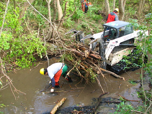
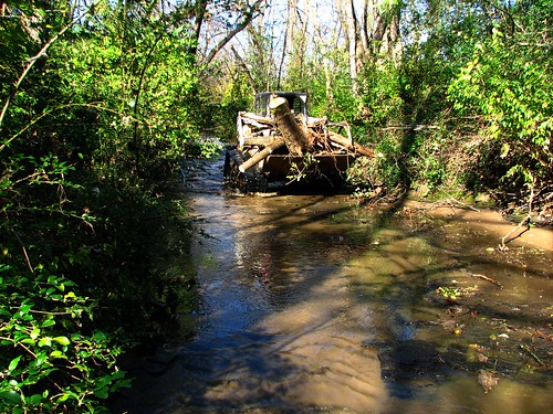
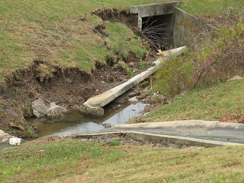
FAYETTEVILLE — City park officials are looking for public comment and review for drainage improvements slated for Red Oak Park.
The work to repair the washed-out stream bank in the park, located at 4600 W. New Bridge Road, is being reviewed by Fayetteville engineering and park officials. Additional public comment will come tonight during the Ward 4 meeting.
Aerial-photo map of the park area below is view with North to the left. Water enters the park from the right and flows to the left and into Hamestring Creek, which flows west to the Illinois River.
The sections of washed-out bank should have been completed months ago. However, funds were diverted from that project to become the matching funds needed for a Water Conservation Resource Center grant to restore the bank of the Niokaska Creek in Sweetbriar Park.
The diversion of funds to Sweetbrier Park, located at 2645 E. Sweetbrier Drive, irked residents and City Council members.
“Obviously, we want to take grants where we can get them, and Sweetbriar’s important,” said Kyle Cook, a Ward 2 alderman, speaking about the project at a September City Council agenda session. “But I don’t want to take money from Red Oak after we’ve already made commitments to these people.”
Money from the city’s drainage fund will be used to fund the Red Oak project, which is moving forward, officials said.
“So from our opinion, they’re both going to be funded,” said Don Marr, Fayetteville chief of staff.
A site for comments and photos of Red Oak Park
MEETING INFORMATION
Ward 4
When: 7 p.m. today
Where: Room 111, Fayetteville City Hall, 113 W. Mountain St.
http://www.flickr.com/photos/7295307@N02/sets/72157603838883972/
Photos of Red Oak Park
Red Oak Park To Be Discussed At Ward 4 Meeting
By Skip Descant
Monday, November 30, 2009
FAYETTEVILLE — City park officials are looking for public comment and review for drainage improvements slated for Red Oak Park.
The work to repair the washed-out stream bank in the park, located at 4600 W. New Bridge Road, is being reviewed by Fayetteville engineering and park officials. Additional public comment will come tonight during the Ward 4 meeting.
Aerial-photo map of the park area below is view with North to the left. Water enters the park from the right and flows to the left and into Hamestring Creek, which flows west to the Illinois River.
The sections of washed-out bank should have been completed months ago. However, funds were diverted from that project to become the matching funds needed for a Water Conservation Resource Center grant to restore the bank of the Niokaska Creek in Sweetbriar Park.
The diversion of funds to Sweetbrier Park, located at 2645 E. Sweetbrier Drive, irked residents and City Council members.
“Obviously, we want to take grants where we can get them, and Sweetbriar’s important,” said Kyle Cook, a Ward 2 alderman, speaking about the project at a September City Council agenda session. “But I don’t want to take money from Red Oak after we’ve already made commitments to these people.”
Money from the city’s drainage fund will be used to fund the Red Oak project, which is moving forward, officials said.
“So from our opinion, they’re both going to be funded,” said Don Marr, Fayetteville chief of staff.
A site for comments and photos of Red Oak Park
MEETING INFORMATION
Ward 4
When: 7 p.m. today
Where: Room 111, Fayetteville City Hall, 113 W. Mountain St.
Sunday, November 29, 2009
Heartwood Gallery on Government Avenue just off Martin Luther King Boulevard in south Fayetteville, Arkansas, offering incentive to donate food to support our local food bank
Benefit the Food Bank
From now until December 20th, bring a canned or non-perishable food item donation to Heartwood Gallery and sign up for a drawing for a $50 gift certificate good toward the purchase of items in the gallery. The drawing will take place on December 20th, just in time for Christmas.
Heartwood Gallery is at 428 S. Government Avenue in Fayetteville, AR. Our phone number is (479) 444-0888.
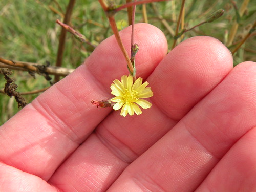
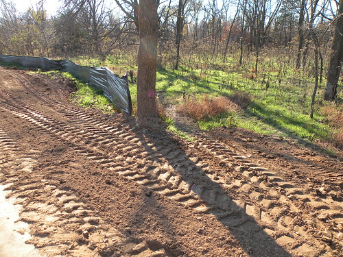
Town Branch neighbors can use help planting native seed in the bad dirt spread along the new Pinnacle Prairie Trail: Plant them and they will grow!
Please click on image to go to Flickr site and enlarge photo from Pinnacle Prairie three sizes or navigate to see related photos from July 28, 2009.
Small, yellow native wildflower on Pinnacle Prairie on July 28, 2009.
Please click on image to go to Flickr site and ENLARGE photo of small, yellow flower beside Pinnacle Prairie on July 28, 2009, and find related photos.
Saturday, November 28, 2009
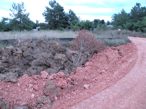
Natural Resources Conservation Service contractors use Bobcat loader in the bed of the Town Branch without permission on day major watershed-protection news announced
Please click on image to go to Flickr site and enlarge and search for related photos and information.
What part of NO don't these guys understand?
The living things in a half mile of this urban tributary of the West Fork of the White River were displaced and their habitat damaged for four days in November 2009 with no apology.
On the day that these photos were taken, the NRCS announced a huge effort to improve water quality in many states, including Arkansas. How does treating the riparian zones of Fayetteville's tributaries of the White River and the Illinois River watersheds make sense when the agency's overall mission includes protecting and enhancing such areas?
Release No. 0586.09
Contact:
Brad Fisher (202) 720-4024
SECRETARY VILSACK ANNOUNCES 41 WATERSHEDS TO TAKE PART IN MISSISSIPPI RIVER BASIN INITIATIVE
Initiative Will Provide Approximately $320 Million in USDA Assistance In Basin Area
WASHINGTON, November 23, 2009 - Agriculture Secretary Tom Vilsack today announced that 41 watersheds in 12 states, known as Focus Areas, have been selected to participate in a new initiative to improve water quality and the overall health of the Mississippi River Basin. The selected watersheds cover over 42 million acres, or more than 5 percent of the Basin's land area.
"The USDA is committed to working cooperatively with agricultural producers, partner organizations and State and local agencies to improve water quality and the quality of life for the tens of millions of people who live in the Mississippi River Basin, the Mississippi River Basin Healthy Watersheds Initiative will help" Vilsack said. "Today's announcement is another step toward achieving this goal, and I encourage as many eligible participants as possible to join us in this major conservation effort."
The Mississippi River Basin Healthy Watersheds Initiative (MRBI), which was announced on September 24, 2009, will provide approximately $320 million in USDA financial assistance over the next four years for voluntary projects in priority watersheds in Arkansas, Kentucky, Illinois, Indiana, Iowa, Louisiana, Minnesota, Mississippi, Missouri, Ohio, Tennessee and Wisconsin. MRBI will help producers implement conservation and management practices that prevent, control and trap nutrient runoff from agricultural land.
USDA's Natural Resources Conservation Service (NRCS) manages the initiative. NRCS State Conservationists from the 12 watershed states selected the watersheds with guidance from State Technical Committees and state water quality agencies. Selections were based on the potential for managing nitrogen and phosphorus -- nutrients associated with water quality problems in the Basin -- while maintaining agricultural productivity and benefiting wildlife.
Next, smaller watershed projects will be selected through a competitive process under NRCS' Cooperative Conservation Partnership Initiative (CCPI). NRCS assistance will be leveraged with contributions from partners, expanding the capacity available to improve water quality throughout the Basin.
Three requests for project proposals will be announced in the next several weeks, including one for CCPI. Funding for CCPI projects will come from NRCS' Environmental Quality Incentives Program, Conservation Stewardship Program and Wildlife Habitat Incentive Program.
Two other requests for proposals will fund projects through the Wetlands Reserve Enhancement Program and Conservation Innovation Grants. For information about these programs, visit www.nrcs.usda.gov/programs .
State(s) Watershed
Arkansas/Missouri - Cache
Arkansas - Lake Conway-Point Remove
Arkansas - L'Anguille
Arkansas/Missouri - Lower St. Francis
Illinois - Lower Illinois - Senachwine Lake
Illinois - Upper Illinois
Illinois - Vermilion (Upper Mississippi River sub-basin)
Illinois/Indiana - Vermilion (Upper Ohio River sub-basin)
Indiana - Eel
Indiana - Upper East Fork White
Indiana - Wildcat
Indiana/Ohio - Upper Wabash
Iowa - Boone
Iowa - Maquoketa
Iowa - North Raccoon
Iowa/Minnesota - Upper Cedar
Kentucky/Tennessee - Bayou De Chien-Mayfield
Kentucky - Licking
Kentucky - Lower Green
Louisiana - Mermentau
Louisiana/Arkansas - Bayou Macon
Louisiana/Arkansas - Boeuf River
Minnesota - Middle Minnesota
Minnesota - Root
Minnesota - Sauk
Mississippi - Big Sunflower
Mississippi/Louisiana/Arkansas - Deer-Steele
Mississippi - Upper Yazoo
Missouri/Iowa - Lower Grand
Missouri - North Fork Salt
Missouri - South Fork Salt
Missouri/Arkansas - Little River Ditches
Ohio/Indiana - Upper Great Miami
Ohio - Upper Scioto
Tennessee - Forked Deer
Tennessee/Kentucky - Obion
Tennessee - South Fork Obion
Tennessee/Kentucky - Red River
Wisconsin/Illinois - Sugar
Wisconsin/Illinois - Upper Rock
Wisconsin/Illinois - Pecatonica
For information about the Mississippi River Basin Healthy Watersheds Initiative, including eligibility requirements, please visit the MRBI web page at http://www.nrcs.usda.gov/programs/mrbi/mrbi_overview.html or your USDA Service Center. A map of the project area is available the MRBI Programs webpage.
Subscribe to NRCS news releases and get other agency information at http://www.nrcs.usda.gov or contact NRCS Public Affairs at 202-720-3210.
NRCS celebrates its 75th year of service in 2010.
USDA is an equal opportunity provider, employer and lender. To file a complaint of discrimination, write: USDA, Director, Office of Civil Rights, 1400 Independence Ave., S.W., Washington, D.C. 20250-9410 or call (800) 795-3272(voice), or (202) 720-6382 (TDD).
Friday, November 27, 2009
Why are the right-wingers always scowling?
Jeff Hankins got his start as a weak sports reporter at the Arkansas Democrat, but now he is on AETN representing the the far right wing.
Now the question is why there isn't a better representative for the tea-baggers available?
At least Rash Limberger smiles now and then while spewing his venom.
Now the question is why there isn't a better representative for the tea-baggers available?
At least Rash Limberger smiles now and then while spewing his venom.
Thursday, November 26, 2009
Blazing star among the brightest lights on south Fayetteville prairies
Blazing star going to seed on November 21, 2009. Theo Witsell says there are several species in Arkansas.
Blazing Star native wildflower going to seed
Aubrey james | MySpace Video
Blazing Star native wildflower going to seed
Aubrey james | MySpace Video
Elliott's bluestem (Andropogon gyrans Ashe) identified by Theo Witsell to the northwest of Pinnacle Prairie
Elliott's bluestem Andropogon gyrans Ashe var. gyrans
Aubrey james | MySpace Video
www.naturalheritage.org
http://www.discoverlife.org/20/q?guide=POPA_USGA
Andropogon gyrans Ashe
Elliott's bluestem
Symbol: ANGY2
Group: Monocot
Family: Poaceae
Duration: Perennial
Growth Habit: Graminoid
Native Status:
L48 N
Click on the image below to enlarge it and download a high-resolution JPEG file.
©James H. Miller. Miller, J.H. and K.V. Miller. 2005. Forest plants of the southeast and their wildlife uses. University of Georgia Press, Athens. Courtesy of University of Georgia Press . Image scanned by Forestry Images . Usage Requirements . Any use of copyrighted images requires notification of the copyright holder.
More Information:
Classification
PM Publications
Data Source and Documentation
Images:
Andropogon gyrans Ashe
See all the Andropogon thumbnails at the PLANTS Gallery
Distribution:
Andropogon gyrans Ashe
View Native Status
See U.S. county distributions (when available) by clicking on the map or the linked states below:
USA ( AL , AR , DC , DE , FL , GA , IL , IN , KY , LA , MD, MO , MS , NC , NJ , OH , OK, PA , SC , TN , TX , VA , WV )
Related Taxa:
Andropogon gyrans Ashe
View 338 genera in Poaceae , 20 species in Andropogon or click below on a thumbnail map or name for species profiles.
Andropogon gyrans var. gyrans
Elliott's bluestem
Andropogon gyrans var. stenophyllus
Elliott's bluestem
Native Introduced
Classification:
Andropogon gyrans Ashe
Click on a scientific name below to expand it in the PLANTS Classification Report.
Kingdom Plantae – Plants
Subkingdom Tracheobionta – Vascular plants
Superdivision Spermatophyta – Seed plants
Division Magnoliophyta – Flowering plants
Class Liliopsida – Monocotyledons
Subclass Commelinidae
Order Cyperales
Family Poaceae – Grass family
Genus Andropogon L. – bluestem
Species Andropogon gyrans Ashe – Elliott's bluestem
Wetland Indicator Status:
Andropogon gyrans Ashe
Andropogon perangustatus [= ANGYS ]:
Nat. Ind. Reg. 1 Reg. 2 Reg. 3 Reg. 4 Reg. 5 Reg. 6 Reg. 7 Reg. 8 Reg. 9 Reg. 0 Reg. A Reg. C Reg. H
OBL NO OBL NO NO NO NO NO NO NO NO NO NO NO
Interpreting Wetland Indicator Status
Wildlife Habitat Values:
Andropogon gyrans Ashe
Large Mammals Small Mammals Water Birds Terrestrial Birds
Source Large Mammals Food Large Mammals Cover Small Mammals Food Small Mammals Cover Water Birds Food Water Birds Cover Terrestrial Birds Food Terrestrial Birds Cover
Miller Minor Low Minor Moderate
Wildlife Habitat Values
Miller, J.H., and K.V. Miller. 1999. Forest plants of the southeast and their wildlife uses . Southern Weed Science Society.
More Accounts and Images:
Andropogon gyrans Ashe
View species account , photographs , and distribution from USF Atlas of Florida Vascular Plants.
View species account , distribution map , and illustration from the Grass Manual on the Web.
View species account from ARS Germplasm Resources Information Network (GRIN).
View taxonomic account from Integrated Taxonomic Information System (ITIS) for ITIS Taxonomic Serial Number 182527.
View photographs and distribution from University of Tennessee Herbarium.
Theo Witsell of the Arkansas Natural Heritage Commission compares little bluestem and broom sedge
Theo Witsell and little bluestem vs broom sedge
Aubrey james | MySpace Video
Little bluestem
Scientific Name: Schizachyrium scoparium (Michx.) Nash.
Common Name: Little bluestem
Morphological Characteristics:
A native, perennial, warm season, long-lived bunchgrass. Culms are 1 to 4 feet tall, erect and large tufted, having occasional short rhizomes. Basal stems and sheaths are flattened. Leaf blades are hairless; V shaped in cross section, keeled, light blue-green when young turning reddish brown at maturity. Ligules 1/16 inch in length, membranous, with singed margins. Inflorescence consists of several unbranched racemes, one on the end of each seed stalk. Spikelets are paired along raceme axis; fertile one plump, awned and stalkless; sterile one stalked, awnless or awn tipped.
Little bluestem has a deep fibrous root system, and may be semi-sod forming in sub humid zones. As a warm season grass it begins growth in late spring and continues through the hot summer period until the first killing frost. It is easily mistaken for common broomsedge (Andropogon virginicus) except little bluestem has very flat bluish basal shoots. Broomsedge has a straight awn and has two or more stalked seed clusters per branch. Little bluestem has a twisted, bent awn and a single cluster of seeds per branch. Seacoast bluestem (Schizachyrium scoparium var. littorale) occurs only in the coastal plain region. It is very similar to little bluestem but can be distinguished by the bent stems at the base, whereas little bluestem stems are erect.
Little bluestem is one of the most widely distributed native grasses in North America. It will grow on a wide variety of soils but is very well adapted to well drained, medium to dry, infertile soils. The plant has excellent drought and fair shade tolerance, and fair to poor flood tolerance. It grows preferentially on sites with pH 7.0 and slightly higher.
Conservation Use:
Why collect this plant?
In north-central Texas there is a lack of locally-adapted native (ecotypic) plant materials for use in revegetation projects. The North Texas Ecotype Project (NTEP) was established to conserve the culturally, historically, and ecologically important native plants of north-central Texas, and promote their use for revegetation projects.
The Knox City Plant Materials Center in cooperation with NTEP have identified little bluestem as a plant meeting project objectives. Plant and seed collections supporting NTEP are targeted for 43 counties located within all or portions of 6 vegetation areas in north-central Texas including: Blackland Prairie, East Cross Timbers, Fort Worth Prairie, Lampasas Cut Plain, West Cross Timbers and Rolling Plains.
Future ecotypes developed will benefits the following conservation practice standards: 645 Upland Wildlife Habitat Management; 342 Critical Area Planting; 562 Recreation Area Improvement; 550 Range Planting; 327 Conservation Cover; 643 Restoration and Management of Rare or Declining Habitats.
Your assistance in collecting this plant helps support the NRCS conservation practice standards which are employed daily to conserve the natural resources of Texas!
Center Requesting Seed:
Knox City Plant Materials Center
How to Collect Seed:
Identify native plant stands in your area. You can go to the following websites for helpful photos http://plants.usda.gov or http://www.noble.org/imagegallery/index.html or www.wildflower.org
Determine if seed is mature. Mature seed is typically dry and will easily separate from the seed head.
Hand strip mature seed by grasping the bottom of the seed head then gently pulling away from the base of the plant. Deposit seed in a brown paper sack. Collect seed from a minimum of 30 to 50 plants.
Label each collection as it is made so collections do not get mixed up. Information required includes: Collector’s name, number of plants collected, location (parish, city, highway, and GPS coordinates), site description (soil type, slope, and plants growing in association).
Complete NRCS-ECS-580; Plant Collection Information Form and mail with collected seeds to the NRCS Plant Materials Center requesting the species.
Knox City Plant Materials Center
3776 FM 1292
Knox City, TX 79529-2514
Helpful Tips:
Look for superior plants that display differences in color, height, or forage abundance and record observations. Differences in growing site or location should be made into separate collections if they are separated by more than 1 mile between sites.
Broomsedge
Andropogon virginicus
Broomgrass, Broomsage, Broomsedge bluestem, Broomstraw, Sage grass, Yellow bluestem
Grass
Several stems may arise from each clump of broomsedge. They will turn yellow-tan in the fall.
©James H. Miller, USDA-NRCS Plants Database
Broomsedge seeds are small and hairy.
©James H. Miller, USDA-NRCS Plants Database
Description
This native warm-season grass is often confused with little bluestem. Compared with little bluestem, broomsedge stems are the more flattened and more densely leafed. Also, broomsedge in the fall/winter is typically yellowish tan, while little bluestem has a bronzy color. It is usually no more than 2 feet tall at maturity. Seeds are light and fluffy. Dense stands are often indicative of acid soils, phosphorus deficiency or overgrazing. Lime and fertilizer application may cause broomsedge to decline or disappear.
Use by bobwhites
Broomsedge's clumpy growth and fine leaves and stems make it an excellent grass for nesting, and the height is preferred for roosting. Stands of broomsedge tend to be "weedy," supporting a diverse mix of annual plants that provide further benefits for bobwhites.
Compare the cross section of a broomsedge stem with that of little bluestem. Broomsedge is more flattened.
Wednesday, November 25, 2009
Tuesday, November 24, 2009
Instructions that Natural Resources Conservation Service contractors are supposed to be following
Please click on image to go to Flickr site and ENLARGE for reading and find related documents and photos.


Monday, November 23, 2009
Sunday, November 22, 2009
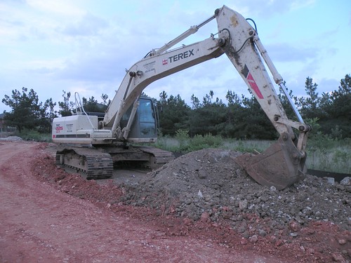
Bobcat loader, other large pieces of equipment and chain saws not examples of manual labor in the destruction of the riparian zone of the Town Branch of the West Fork of the White River: Removing sediment from the stream, however, would actually help protect area homes from flooding and protect the quality of Beaver Lake water
Please click on image to go to Flickr site and ENLARGE view of Bobcat loader driving down the Town Branch of the West Fork of the White River and muddying the stream flow with every run.
Saturday, November 21, 2009
Who lied to me about using only manual labor to clear ice-storm debris from the Town Branch?
Just opened email from a neighbor on S. Van Buren Avenue that
BACKHOES were working in the Town Branch near 15th Street on Saturday:
Subject: Creek
"thought you might be interested to know that they have backhoes and junk in the creek behind our house. noisy and tearing stuff up. not happy."
Did someone LIE to me a week or so ago and previously when I was told that the work authorized to clear debris from the Town Branch would be done ONLY with manual labor?
Theo Witsell of the Arkansas Natural Heritage Commission after presenting a slide show on newly found wildflower species and rare habitat in Arkansas
Please click on image to go to Flickr site and ENLARGE view of Theo Witsell of the Arkansas Department of Heritage after presenting a program on rare plants and rare habitat to the Flower, Garden and Nature Society on November 21, 2009, in Springdale, Arkansas.
Friday, November 20, 2009
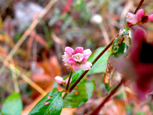
Theo Witsell of the Arkansas Natural Heritage Commission to speak at 9:30 a.m. Saturday in Springdale on rare habitat and newly found wildflower species
Please click on image to go to Flickr site and enlarge to large size for better view of smartweed in flower on November 20, 2009, in Fayetteville, Arkansas. Smartweed, unlike the subjects of Witsell's lecture Saturday morning, is among the most common wildflowers in Northwest Arkansas.
Please click on image to ENLARGE view of invitation to FGNS meeting on November 21, 2009.
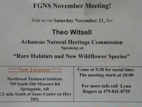
Please click on image to ENLARGE view of invitation to FGNS meeting on November 21, 2009.
Executive VP of Rogers-Lowell Area Chamber of Commerce takes command of Ozark Natural Science Center
Enhancing the understanding, appreciation and stewardship of the Ozark natural environment.
Press Release
For immediate release: November 10, 2009
Ozark Natural Science Center Announces Executive Director
Begin: The Ozark Natural Science Center has announced that Bethany Stephens will serve as the
organization’s new executive director effective November 30.
Stephens is currently executive vice president of the Rogers-Lowell Area Chamber of Commerce,
the largest chamber in Arkansas and one of just fifty nationwide to attain five star accreditation. She is responsible for economic development, sales, marketing and operations functions. Previous roles include executive director of the Rogers Convention & Visitors Bureau within the chamber from 2002 to 2006, and community partnership manager for Big Brothers Big Sisters of Northwest
Arkansas from 1998 to 2002. Stephens is a graduate of the University of Arkansas and lives with her husband and daughter in historic downtown Rogers.
"We are excited to find someone with Beth's experience and skills to continue to grow the Ozark
Natural Science Center. She will bring a wealth of enthusiasm, community connections and business savvy to her new role. In addition to strong communication and marketing skills, Beth also has a deep passion for the natural environment and education. We look forward to a new chapter under her leadership.” Tomek Siwiec, vice president of the ONSC board of directors.
“I am extremely happy that Beth Stephens has accepted the offer to be the executive director of the Ozark Natural Science Center. I have known and respected Beth for a number of years and I am certain that she will do a tremendous job. I look forward to working with Beth in her new position.”
David Thrasher, ONSC board of directors.
The Ozark Natural Science Center is a private, nonprofit field-science education facility on the Arkansas Natural Heritage Commission’s Bear Hollow Natural Area in rural Madison county
between Eureka Springs and Huntsville. ONSC offers summer camps and adult and family
programming, but is best known as the site of life-altering school excursions for nearly 4,000 public- and private-school students from Arkansas and beyond each year. The ONSC campus includes three lodges, guest and faculty housing, indoor and outdoor classrooms, an observation deck and
nearly eight miles of maintained hiking trails. The facility is an ideal setting for private group programs such as corporate sustainability education or organizational planning retreats. ONSC employs a team of 19 administrative, food service and maintenance staff as including field-staff with backgrounds ranging from aquatic resources to zoology.
###
Contacts: David Thrasher – Thrasher Investments/ONSC Board (479.273.5333 or thrasherinvest@thrasherfinancial.com)
Tomek Siwiec – Arvest Bank/ONSC Board (479.986.3796 or tsiwiec@arvest.com)
Bethany Stephens – ONSC Executive Director (479.633.7619 or beth@onsc.us)
Ozark Natural Science Center
479.789.2754 • www.ONSC.us
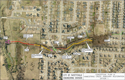
Red Oak Park plan to be presented a second time at Ward 4 meeting in city hall at 7 p.m. Monday, November 30, 2009
Public Meeting
Hamestring Tributary Restoration
through Red Oak Park
5:30 PM Thursday, November 19, 2009
Public Meeting Handout.11-19-09 Page 1 of 3
I. Existing Conditions and Explanation of Problem:
• The approximately 100-acre watershed that is draining through Red Oak Park COMPRISES
mostly 1⁄4-acre residential lots. Predevelopment land use was undeveloped pasture.
Undeveloped pasture 20% to 30% storm water runoff
Residential development 60% to 75% storm water runoff
• The average storm water velocity within the park area and the downstream property computed
by the City Engineering staff in 2004 was approximately 10 feet per second.
• The soils (cherty silt loam) are highly susceptible to erosion and the stream will likely continue to
erode due to the geology of the adjacent soils, the volume of storm water and the resulting high
velocities. However, survey data obtained in 2009 shows minimal changes in the stream
channel when compared to the data collected in 2004 which may indicate that the erosion is
stabilizing somewhat.
• Several mature trees that are in close proximity to the channel are in danger of falling due to the
erosion within the root systems. Approximately 15 trees were removed within the park after the
January 2009 ice storm.
• The railroad ties in the upstream portion of the channel are washing downstream.
• Severe erosion has occurred around the gabion structures located in the northern area of the
park. The Parks and Recreation staff has removed one gabion structure to alleviate flooding and
erosion.
• Severe erosion is also occurring on the property downstream from the park. The downstream
property owner removed approx. 35 dump truck loads of gravel from a manmade dam area in
2002. The same level of sedimentation returned in less than two years.
II. Where Have We Been?
1986 Aerial photographs show the immediate area around what is now Red Oak Park as wooded.
The aerial shows the land use from Wedington Drive north to Hamestring Creek and from 51st
Avenue east to Rupple Road was undeveloped. A small subdivision existed just north of
Wedington Drive, and a few chicken houses were scattered throughout this area.
2004 A drainage study was performed by the City Engineering staff. Recommendations included 400
feet of 60” diameter storm pipe and 600 feet of creek stabilization using native stone boulders,
compacted hillside material and colored concrete on the section south of New Bridge Road. On
the section north of New Bridge Road, 275 feet of 66” diameter storm pipe with a small grass-
lined swale was recommended.
2007 Mr. Dave Evans, Region 1 Stream Team Coordinator of the Arkansas Game and Fish
Commission (AGFC), provided another design to attempt to resolve the erosion problems that
exist in the stream that bisects the park. A permit for this design was obtained from the U.S.
Army Corps of Engineers (USACE). Proposed project included:
♦ Removal of the existing concrete, railroad ties and gabion structures;
♦ Significant tree removal (approximately 55 to 70 trees);
♦ Modification of the existing channel to create a larger area to handle runoff events which
included shaping one or both banks to increase the total channel area;
♦ Construction of approximately 20 pairs and 14 individual rock plunge pools within the newly
shaped channel; and
♦ Tree and shrub planting plan to establish vegetation.
Parks and Engineering staff began to reconsider the natural stream channel approach after the
stream restoration project was completed at Gulley Park.
Public Meeting
Hamestring Tributary Restoration
through Red Oak Park
5:30 PM Thursday, November 19, 2009
Public Meeting Handout.11-19-09 Page 2 of 3
II. Where Have We Been? (continued)
2009 Additional drainage calculations and analyses were performed by the City Engineering staff.
Recommendations include two options as shown in the drawings and as described below:
Table 1. Comparison of Design Options
Description Pros Cons Cost Estimates*
Option 1
Debris collection at south end of
park; channel restoration thru
park; one 24” dia. pipe and one
36” dia. pipe in park; stilling
basin on north end of park; two
42” dia. pipes and plunge pool
on adjacent property north of
park.
Design will resolve the
erosion problems in the
park
Will allow for some
reclamation of park land
near New Bridge Road
Significantly less tree
removal within park than
AGFC design
More expensive than
Option 2
Will not provide
significant infiltration
of storm water
In Red Oak Park -
$320,000
Downstream -
$170,000
Total $490,000
Option 2
Control structure with debris
collection in park south of New
Bridge Road; removal of
existing park pavilion; no
channel restoration thru park; no
pipes in park; stilling basin on
north end of park; two 42” dia.
pipes and plunge pool on
adjacent property north of park.
Will allow for some
infiltration of storm water
in the park south of New
Bridge Road
Basically no tree
removal within park
Less expensive than
Option 1 allowing for
park funds to be utilized
at Bryce Davis Park
(new Community Park
under design) or at the
southernmost 2.25 acres
of Red Oak Park
Design will not
resolve the erosion
problems in the park
Existing park will be
reclassified and used
only as a natural
greenway area
In Red Oak Park -
$65,000
Downstream -
$150,000
Total $215,000
* Cost Estimates include construction by outside contractor(s)
III. Funding Items:
• This project is funded with Sales Tax funds. The cost estimates shown in Table 1 above include
construction by outside contractor(s). Cost estimates of materials only for each option are:
Option 1 (Materials Only): In Red Oak Park-$166,000; downstream $96,000 Total $262,000
Option 2 (Materials Only): In Red Oak Park-$35,000; downstream $85,000 Total $120,000
• Earlier plan included partnering with the Arkansas Game and Fish Commission. The cost
estimate for Materials Only was $99,530. The project was financially viable because of the
assistance of AGFC staff (at no cost to the City) and the use of City staff and equipment for tree
removal, excavation, placement of stone and revegetation with grass. The use of volunteers for
the planting of the shrubs and trees also kept the project cost low.
Public Meeting
Hamestring Tributary Restoration
through Red Oak Park
5:30 PM Thursday, November 19, 2009
Public Meeting Handout.11-19-09 Page 3 of 3
IV. Where Are We Going?
• Storm water detention in the upper area of the watershed is most likely not possible due to the
development. Engineers from the local USDA offices performed a preliminary assessment of the
site to determine the size of detention basin that would be required to contain the flow. Their
preliminary assessment concluded that there is not enough area available for detention.
Additionally. City Engineering Staff confirmed that detention is not an option without significant
tree removal and earthwork (i.e., removal of all trees and several feet of excavation of the entire
park area).
• The use of rain gardens is not likely feasible due to the fact that the City cannot require
residents to install and maintain the gardens on their properties. Additionally, a comprehensive
study must be performed to determine the best placement of rain gardens, etc. The bulk of the
storm water flow into the channel that runs through Red Oak Park is coming from the streets
and underground piping associated with the surrounding subdivisions. In addition, rain gardens
are typically designed for two-year or smaller rain events, and larger storm event flows and
velocities are not affected by rain gardens.
• Any work in the channel requires a Section 404 permit from the U.S. Army Corps of Engineers
(USACE), and any new or different design will require a new application to the Corps.
Proposed Schedule of Events:
• Select an option based on public input.
• Complete the construction documents for the chosen design and re-submit to the USACE for
approval and permitting.
• After approval and permitting by USACE, the project may be advertised for bids.
• Construction can begin after a qualified contractor is selected.
V. Questions and Comments
Public Meeting
Hamestring Tributary Restoration
through Red Oak Park
5:30 PM Thursday, November 19, 2009
Please use this sheet to submit your written comments to the Parks and Recreation Department. You are not
required to include your name and address, but we have provided a space for you to do so if you would like.
Please send your completed form to the address at the bottom of this sheet by December 4, 2009. Thank you
for taking time to comment on this important issue.
Do you prefer proposed Option 1 which includes channel restoration through Red Oak Park or proposed
Option 2 which does not include any channel restoration through Red Oak Park or “Other” option(s)? (Please
mark one below)
___________ I prefer Option 1.
___________ I prefer Option 2.
___________ I prefer “Other” option(s).
Please write any additional comments below as to these two options or other ideas/options you wish to offer:
Name Address Phone E-mail
Return to: Fayetteville Parks and Recreation Department
113 West Mountain Street
Fayetteville, AR 72701
Phone: (479) 444-3471 ext. 471
Fax: (479) 521-7714
Email: parks_and_recreation@ci.fayetteville.ar.us
Hamestring Tributary Restoration
through Red Oak Park
5:30 PM Thursday, November 19, 2009
Public Meeting Handout.11-19-09 Page 1 of 3
I. Existing Conditions and Explanation of Problem:
• The approximately 100-acre watershed that is draining through Red Oak Park COMPRISES
mostly 1⁄4-acre residential lots. Predevelopment land use was undeveloped pasture.
Undeveloped pasture 20% to 30% storm water runoff
Residential development 60% to 75% storm water runoff
• The average storm water velocity within the park area and the downstream property computed
by the City Engineering staff in 2004 was approximately 10 feet per second.
• The soils (cherty silt loam) are highly susceptible to erosion and the stream will likely continue to
erode due to the geology of the adjacent soils, the volume of storm water and the resulting high
velocities. However, survey data obtained in 2009 shows minimal changes in the stream
channel when compared to the data collected in 2004 which may indicate that the erosion is
stabilizing somewhat.
• Several mature trees that are in close proximity to the channel are in danger of falling due to the
erosion within the root systems. Approximately 15 trees were removed within the park after the
January 2009 ice storm.
• The railroad ties in the upstream portion of the channel are washing downstream.
• Severe erosion has occurred around the gabion structures located in the northern area of the
park. The Parks and Recreation staff has removed one gabion structure to alleviate flooding and
erosion.
• Severe erosion is also occurring on the property downstream from the park. The downstream
property owner removed approx. 35 dump truck loads of gravel from a manmade dam area in
2002. The same level of sedimentation returned in less than two years.
II. Where Have We Been?
1986 Aerial photographs show the immediate area around what is now Red Oak Park as wooded.
The aerial shows the land use from Wedington Drive north to Hamestring Creek and from 51st
Avenue east to Rupple Road was undeveloped. A small subdivision existed just north of
Wedington Drive, and a few chicken houses were scattered throughout this area.
2004 A drainage study was performed by the City Engineering staff. Recommendations included 400
feet of 60” diameter storm pipe and 600 feet of creek stabilization using native stone boulders,
compacted hillside material and colored concrete on the section south of New Bridge Road. On
the section north of New Bridge Road, 275 feet of 66” diameter storm pipe with a small grass-
lined swale was recommended.
2007 Mr. Dave Evans, Region 1 Stream Team Coordinator of the Arkansas Game and Fish
Commission (AGFC), provided another design to attempt to resolve the erosion problems that
exist in the stream that bisects the park. A permit for this design was obtained from the U.S.
Army Corps of Engineers (USACE). Proposed project included:
♦ Removal of the existing concrete, railroad ties and gabion structures;
♦ Significant tree removal (approximately 55 to 70 trees);
♦ Modification of the existing channel to create a larger area to handle runoff events which
included shaping one or both banks to increase the total channel area;
♦ Construction of approximately 20 pairs and 14 individual rock plunge pools within the newly
shaped channel; and
♦ Tree and shrub planting plan to establish vegetation.
Parks and Engineering staff began to reconsider the natural stream channel approach after the
stream restoration project was completed at Gulley Park.
Public Meeting
Hamestring Tributary Restoration
through Red Oak Park
5:30 PM Thursday, November 19, 2009
Public Meeting Handout.11-19-09 Page 2 of 3
II. Where Have We Been? (continued)
2009 Additional drainage calculations and analyses were performed by the City Engineering staff.
Recommendations include two options as shown in the drawings and as described below:
Table 1. Comparison of Design Options
Description Pros Cons Cost Estimates*
Option 1
Debris collection at south end of
park; channel restoration thru
park; one 24” dia. pipe and one
36” dia. pipe in park; stilling
basin on north end of park; two
42” dia. pipes and plunge pool
on adjacent property north of
park.
Design will resolve the
erosion problems in the
park
Will allow for some
reclamation of park land
near New Bridge Road
Significantly less tree
removal within park than
AGFC design
More expensive than
Option 2
Will not provide
significant infiltration
of storm water
In Red Oak Park -
$320,000
Downstream -
$170,000
Total $490,000
Option 2
Control structure with debris
collection in park south of New
Bridge Road; removal of
existing park pavilion; no
channel restoration thru park; no
pipes in park; stilling basin on
north end of park; two 42” dia.
pipes and plunge pool on
adjacent property north of park.
Will allow for some
infiltration of storm water
in the park south of New
Bridge Road
Basically no tree
removal within park
Less expensive than
Option 1 allowing for
park funds to be utilized
at Bryce Davis Park
(new Community Park
under design) or at the
southernmost 2.25 acres
of Red Oak Park
Design will not
resolve the erosion
problems in the park
Existing park will be
reclassified and used
only as a natural
greenway area
In Red Oak Park -
$65,000
Downstream -
$150,000
Total $215,000
* Cost Estimates include construction by outside contractor(s)
III. Funding Items:
• This project is funded with Sales Tax funds. The cost estimates shown in Table 1 above include
construction by outside contractor(s). Cost estimates of materials only for each option are:
Option 1 (Materials Only): In Red Oak Park-$166,000; downstream $96,000 Total $262,000
Option 2 (Materials Only): In Red Oak Park-$35,000; downstream $85,000 Total $120,000
• Earlier plan included partnering with the Arkansas Game and Fish Commission. The cost
estimate for Materials Only was $99,530. The project was financially viable because of the
assistance of AGFC staff (at no cost to the City) and the use of City staff and equipment for tree
removal, excavation, placement of stone and revegetation with grass. The use of volunteers for
the planting of the shrubs and trees also kept the project cost low.
Public Meeting
Hamestring Tributary Restoration
through Red Oak Park
5:30 PM Thursday, November 19, 2009
Public Meeting Handout.11-19-09 Page 3 of 3
IV. Where Are We Going?
• Storm water detention in the upper area of the watershed is most likely not possible due to the
development. Engineers from the local USDA offices performed a preliminary assessment of the
site to determine the size of detention basin that would be required to contain the flow. Their
preliminary assessment concluded that there is not enough area available for detention.
Additionally. City Engineering Staff confirmed that detention is not an option without significant
tree removal and earthwork (i.e., removal of all trees and several feet of excavation of the entire
park area).
• The use of rain gardens is not likely feasible due to the fact that the City cannot require
residents to install and maintain the gardens on their properties. Additionally, a comprehensive
study must be performed to determine the best placement of rain gardens, etc. The bulk of the
storm water flow into the channel that runs through Red Oak Park is coming from the streets
and underground piping associated with the surrounding subdivisions. In addition, rain gardens
are typically designed for two-year or smaller rain events, and larger storm event flows and
velocities are not affected by rain gardens.
• Any work in the channel requires a Section 404 permit from the U.S. Army Corps of Engineers
(USACE), and any new or different design will require a new application to the Corps.
Proposed Schedule of Events:
• Select an option based on public input.
• Complete the construction documents for the chosen design and re-submit to the USACE for
approval and permitting.
• After approval and permitting by USACE, the project may be advertised for bids.
• Construction can begin after a qualified contractor is selected.
V. Questions and Comments
Public Meeting
Hamestring Tributary Restoration
through Red Oak Park
5:30 PM Thursday, November 19, 2009
Please use this sheet to submit your written comments to the Parks and Recreation Department. You are not
required to include your name and address, but we have provided a space for you to do so if you would like.
Please send your completed form to the address at the bottom of this sheet by December 4, 2009. Thank you
for taking time to comment on this important issue.
Do you prefer proposed Option 1 which includes channel restoration through Red Oak Park or proposed
Option 2 which does not include any channel restoration through Red Oak Park or “Other” option(s)? (Please
mark one below)
___________ I prefer Option 1.
___________ I prefer Option 2.
___________ I prefer “Other” option(s).
Please write any additional comments below as to these two options or other ideas/options you wish to offer:
Name Address Phone E-mail
Return to: Fayetteville Parks and Recreation Department
113 West Mountain Street
Fayetteville, AR 72701
Phone: (479) 444-3471 ext. 471
Fax: (479) 521-7714
Email: parks_and_recreation@ci.fayetteville.ar.us
Beaver Lake group forms partnership to protect water supply by protecting lake's watershed
But some people aren't certain there is a need.
“Why are we doing this? What drives this?” asked George Graen, who said he believes there is nothing wrong with the watershed as it is.
Graen, who lives on the lake, said he’s concerned with the prospect of having another layer of regulation when water quality is improving. He said he thinks the watershed is in good shape, but that doesn’t mean such a partnership couldn’t be useful.
That is from the Northwest Arkansas edition of the Arkansas Democrat/Gazette.
I was glad the reporter, Adam Wallworth, included that snippet, which must represent the opinion of thousands.
It reminds me why I persevere, even perseverate, in my effort to show examples of how badly our watershed is being treated.
It is wonderful that thousands of others understand. The only way to have any hope that the majority will ever come to realize the importance of protecting the Beaver Lake watershed is to keep publicizing the problems and solutions and BELIEVE that each attempt will make an impression on someone who may be motivated to support and help guide that new partnership.
Theo Witsell of the Arkansas Natural Heritage Commission to speak on rare habitat and newly found wildflower species
Please click on image to ENLARGE view of invitation to FGNS meeting on November 21, 2009.
Old letter to U.S. Corps of Engineers' Little Rock offices briefly describes reasons the Town Branch watershed should have been protected
Please click on title above to view original page on old Web site in 2003. The photo made from a farm house yard early in the 20th Century showed the landscape as it appeared 60 or maybe 75 years after the early settlers had clearned the land immediately south of what is now known as Martin Luther Boulevard and before second-growth timber had made the area a beautiful forest that was not removed until 2005.
Print, sign and mail this letter! >DOWNLOAD LETTER HERE • Gather more signatures — DOWNLOAD PETITION HERE
PROTECT TOWN BRANCH WATERSHED
Timothy Scott
Environmental Specialist
Planning, Environmental and Regulatory Division
U.S. Corps of Engineers
P.O. Box 867
Little Rock, Arkansas 72203-0867
Dear Mr. Scott:
Members of the Town Branch Neighborhood Association respectfully request that a careful study of the Town Branch Basin in south Fayetteville, Arkansas, be undertaken before any permits are issued for projects that involve alteration of wetland areas along and near tributaries of the Town Branch of the West Fork of the White River.
We wish particularly to see a complete study of the historical, environmental, archeological, hydrological and sociological values of the area along and west of S. Hill Avenue, S. Duncan Ave., Ellis Avenue and Van Buren Ave. from Sixth to 15th with attention to the potential impact of upstream wetland alteration on floodwater levels and water quality downstream.
Of most immediate concern is the 2-acre parcel of wetland listed as Project 18017 by the Corps of Engineers' Little Rock District and submitted for permit approval by EB Landworks of Fayetteville and James Mathias. The acreage is a remnant of moist-soil mounded prairie that currently naturally stores and cleanses water that falls on it and provides habitat for many species of birds, small mammals and such subterranean species as burrowing crayfish. Existing development adjacent to and near the project land includes relatively little pavement, allowing the original underground water courses to function. This development, however, could radically change that process. Further development to the north could have an even more detrimental effect.
The Town Branch Basin deserves protection because of its special qualities for human beings and the natural wildlife corridor it represents.
Old US Geological Survey map of south Fayetteville, Arkansas, useful for people studying the watershed today
Please click on image to go to Picasa site and ENLARGE half-century-old map of Town Branch watershed with updates added over the years but far from update.
The word "Town" may be seen on the portion of the Town Branch between Ellis and Van Buren avenues.
The word "Town" may be seen on the portion of the Town Branch between Ellis and Van Buren avenues.
 |
| From Town Branch Neighborhood—Fayetteville, Ark |
 |
| From |
Thursday, November 19, 2009
Arkansas Traveler article addresses pollution problems of water flowing south of the campus and through the Town Branch of the West Fork of the White River to Beaver Lake
 |
| Aubrey Shepherd Outdoors |
Posted on 18 November 2009
Tags: campus, creek, environment, pollution
By Samuel Letchworth
From flash floods to erosion to watershed pollution, Mullins Creek on the UA campus poses serious problems for the Northwest Arkansas community.
Mullins Creek, also known as College Branch Creek, runs from Reid Hall to Lot 56 across the southwest quadrant of the UA campus. It’s located in such an area that its storm watershed flows off into both the Illinois and the White River, and it’s on the Environmental Protection Agency’s list of impaired streams.
Water channeled into Mullins Creek from roads, buildings, parking, etc., exceeds the streams carrying capacity – or the ability to maintain normal ecological functions, according to research done by the UA Community Design Center. In addition, the research found that excessive fertilizer and other lawn maintenance agents used on local landscapes drain to the stream, altering its nutrient composition and aquatic wildlife balance.
Photo by Larry Ash
“The problem with this stream is that it has no natural floodplains and pollutants are dumped, not filtered, into it daily,” says Jeff Huber, Project Designer for the UACDC. “Because it runs through campus, that stream is polluted with everything from oil to heavy metals, from things off cars to things off buildings. A lot of it is petroleum based.”
The Arkansas Department of Environmental Quality assessments determined that Mullins Creek had the highest sediment load in the entire West Fork-White River Watershed. The first hour of stormwater runoff has a pollution index greater than that of raw sewage, according to UACDC research.
Perhaps the greatest threat Mullins Creek poses is to our own drinking water. “A storm occurs and that creek floods and runs off. It goes into the West Fork of the White River and it comes back into Beaver Lake,” says Huber. “Beaver Lake is where our drinking water comes from. If we don’t treat this here on campus, we won’t have a water supply.”
Despite all this, no environmental agency has a record of water quality from having ever tested the creek. Not the U.S. Geological Survey, not the EPA, and not any department on campus. Only sediment load evaluations have been done, and, those, infrequently.
The UA commissioned the Community Design Center to design a solution for the creek water runoff when the EPA starting putting the pressure on four years ago. The project is known as Campus Hydroscapes. The only stipulation from the university was that no parking spaces from Lot 56 could be removed, making the job that much more complicated. But the Center produced numerous designs wherein flood plains could be carved out of Lot 56 and earthen mounds could be introduced at the head of the creek, as well as deep-rooted vegetation. All of these, insists the UACDC, would be viable solutions to curb the problem and would cost under $1 million.
The UA has had the comprehensive, 117-page design for four years but has yet to put any of the plans into application.
Steven Luoni is the director of the UACDC. “Headwater conditions are critical to the health of a watershed,” says Luoni. “Because the stream runs underground beneath the football stadium and practice fields before ‘daylighting’ in the athletic valley, the creek loses its ecological capacity.”
The ecological duress of Mullins Creek is evinced in its wildlife, or lack thereof. Of 63 types of fish found in West Fork Watershed, only one type, the tiny Central Stoneroller, is found in Mullins Creek. “This is certainly an indication of water quality,” says Huber. “Once that last fish is gone you have almost no hope of restoring the system back to its natural state.”
Pollution isn’t the only worry. Excessive flow rates and stream bank loss of Mullins Creek now threaten walkways and bridges, including one on Arkansas State Highway 62, according to UACDC research.
Lot 56 is historically a wetland. As outlined in the Campus Hydroscapes project, Lot 56 would ideally return to a marsh and the problems posed by Mullins Creek would cease to exist. But the UACDC worked around the parking spaces.
“It is a challenge because we only have a limited amount of space to work with in solving this problem,” says Huber. “We can’t go in under the stadiums so we have to nip this at the head of the stream. The area we have to work with is a very small grid between Bud Walton Arena and the parking lot, but there are solutions for keeping contaminated water from running off of campus into rivers.”
The plan is a holistic one: Just let plants do their jobs. The Hydroscapes project calls for introducing plants that have deep fibrous material to allow water to be filtered through the sub-surface. The design explains that any healthy ecological system has a healthy microbial community handled by deep soil and deep rooting plants.
“Microbes are nature’s tillers,” says Huber, “And soil is the sponge of urban development.” The research used in outlining the Campus Hydroscapes plan indicates that if the proper vegetation were introduced to the head of Mullins Creek there would be a 90 percent reduction of water volume leaving the college site and the pollution index would be brought back 75 percent over time.
Whatever the reasons for the UA’s reluctance to green-light the project, Mullins Creek continues to become more impaired with every rainfall. “It is a huge burden to take a paradigm shift,” says Huber. “If you feed something to someone long enough they think that’s their diet. But it’s still unhealthy. Mullins Creek is unhealthy.”
This post was written by:
Samuel Letchworth - who has written 32 posts on The Arkansas Traveler.
Contact the author
« Nelson makes impact regardless of positionPomfret resident arrested for attempting to manufacture ecstasy »
2 Responses to “Campus creek pollutes Fayetteville water supply”
Nick Brown says:
November 19, 2009 at 3:37 pm
The U of A’s stewardship of Mullins Creek is certainly not what it should be. But the title and the main theme of Mr. Letchworth’s story are misleading and not supported by scientific facts.
The university worked on our stretch of the creek in the 90s by creating a pool and riffle fall from the outfall beneath Maple Hill Apts to Maple St, by adding boulders and erosion control fabric in the Leroy Pond Rd to MLK Blvd stretch, and by re-forming the channel to better accomodate stormwater runoff. Since then, nature’s forces, increased opacity of the watershed that feeds the stream (i.e., building and parking lot developments at UA) and more intensive car and truck traffic by campus users have undone much of what worked well 15 years ago. It’s time to maintain and restore the creek to high integrity again, and we’re in the planning process of doing just that. I invite Mr. Huber, Mr. Letchworth and the campus community to collaborate with the Planning and Capital Improvements Division of Facilities Management and the Sustainability Council in developing a sound and effective restoration plan.
Mr. Huber’s suggestion that pollutants are dumped, not filtered into the creek is supported to some extent by fact (the Maple St to Leroy Pond Rd is an underground box culvert), but The Gardens and the greenspace north and west of Bogle Field do in fact provide some filtering of stormwater runoff before it reaches the streambed.
The story does not describe the pollution index by which one might claim that the creek is more polluted than raw sewage, but such a statement is misleading. It’s likely that hydrocarbons and some heavy metals are higher in Mullins Creek after a rainfall event than in some discharges of sewage effluent, but pathogens, antibiotics and chlorine-based compounds are almost certainly orders of magnitude higher in sewage than in Mullins Creek. Mr. Letchworth makes the claim that no agency or academic department of the university has ever performed chemical analyses of the creek’s water. How, then, can he say that it’s more polluted than raw sewage?
As for fish diversity in the creek, I’ve personally seen three species of fish (shiners, bluegill, bass) there over the past two years and I suspect that there are more, although I have not attempted scientific analysis of fish diversity. Whether the final individuals of existing populations survive current impacts has little bearing on the long-term potential to restore the ichthyological biodiversity or the overall ecological integrity of the stream.
Biodiversity conservation and climate change are the defining issues of our times, and I strongly support efforts to raise awareness, implement strategies and enact protections to reverse habitat degradation and species extinctions. The job is made more difficult when misinformation about pollution and biodiversity splatter the headlines.
Finally, it is unclear whether the notion that pollution from Mullins Creek threatens the quality of drinking water in Fayetteville comes from Mr. Letchworth or Mr. Huber. (”If we don’t treat this here on campus, we won’t have a water supply.”) Beaver Water District, which supplies water from Beaver Lake to over a quarter million denizens of NW AR, has never–in 38 years of delivering hundreds of billions of gallons of water to area residents–had a single instance of non-compliance with the Safe Drinking Water Act standards or with State drinking water quality standards.
Respectfully,
Nick Brown
Director for campus sustainability
Adjunct assistant professor for geosciences
Amy Wilson says:
November 19, 2009 at 4:36 pm
Thank you for writing this article. This is an issue many folks have worked on the past several years. A follow up article providing some more in-depth information might include an interview with Melissa Terry (who once worked for Audubon and did work on Mullins) and connecting this situation with the World Peace Wetland (Aubrey Shepherd is a contact and Tyson Foods helped with this effort) nearby, that has been set aside but is an ongoing project that needs public support and understanding. World Peace Wetland Prairie is down Hill Street a ways (turn by Brenda’s Bigger Burger). Contact Melissa at melissaterry@yahoo.com and contact Mr. Shepherd at aubreyshepherd@hotmail.com.
Wednesday, November 18, 2009
Historic home on the 2 acres proposed for the dog-boarding kennel
Please click on image to move to Flickr site and ENLARGE and find related photos.
Krupa Drive intersection with S Shiloh Drive is one of many places where heavy rain storms of past months and years have undercut road edges and caused similar problems
Use the ENLARGEMENT tool to get down for a close view and maybe more of today's photos will be added soon.
View Larger Map
View Larger Map
Today's featured highway-erosion site in Northwest Arkansas: It is evidence of why the site of the dog daycare facility would be a reasonable project on the 2-acre site at 2650 W. Old Farmington Road
Stormwater-damage at Shiloh Drive and Krupa Drive on west side of I-540. This is where water from several relatively new developments gathers to go under the access road and eventually comes out on the east side of the Interstate and flows southeast as one of the heavy-load tributaries of the west arm of the Town Branch of the West Fork of the White River and joins Cato Springs Branch at Greathouse Park and then joins the main Town Branch flow from the UA campus and Hill Place student apartments near the Salvation Army store just west of U.S 71 B (S School Avenue).
Below is a map pinpointing the site of the proposed dog-boarding facility at 2650 W. Old Farmington Road. The dog park would like require relatively little disturbance of soil and would protect more pervious areas where water would continue to soak in rather than join the water rushing from hotels, retail developments and housing developments on that southeast slope toward the dangerous erosion spot shown in the photo above.
View Larger Map
Gentler trail-building work could protect many acres of wetland in Fayetteville, Arkansas
Please click on image to go to Flickr site and enlarge view of Lake Fayetteville Trail-construction damage to soil and trees and also navigate to see many other related photos.
Tuesday, November 17, 2009
Brenda Gullett of the Arkansas Board of Education speaks to Senior Democrats on November 17, 2009, in Springdale
Please click on image to go to Flickr site to ENLARGE photo of Brenda Gullett and find related photos of people at the November 17, 2009.

Environmental Action Committee discusses need for soft-surface trails in wooded and wetland areas and building paved trails only where they can be relatively harmless
Please click on image to go to Flckr site and ENLARGE view of entry to Lake Fayetteville Trail from Arkansas 265 on November 5, 2009.
I tuned in City 16 this morning near the end of the showing of the November 12, 2009, meeting of the Environmental Action Committee to hear a heartening discussion of trail building in Fayetteville, Arkansas.
Please click on title of this post to find this week's government-channel schedule and look for next time the environmental-action committee meeting is to be shown.
Monday, November 16, 2009
President Obama in China speaking live now on C-Span, channel 17 on Cox cable or use link below online or click on this headline
http://www.c-span.org/Watch/C-SPAN_rm.aspx
Tonight may be the night a lot of late-blooming flowers get frozen
Please click on image to ENLARGE view of purple flower on the front edge of World Peace Wetland Prarie on November 15, 2009.
Senior Democrats meeting at 11:30 a.m. Tuesday November 17, 2009
Hello Everyone!
Below is a quick notice from Bonnie Cook regarding Senior Democrats tomorrow. It is at the Western Sizzlin in Springdale. Make sure to attend!
We are very fortunate to have Brenda Gullett as our guest speaker at Senior Democrats on Tuesday, November 17th. Brenda is on the State Board of Education. She served four years as a State Senator and two as a State Representative. Brenda continues to participate in many other activities. Brenda's topic will be: Charter Schools and Home Schooling verses Traditional Public Schools in Arkansas--Pros and Cons. A question and answer period will follow.
Here are some other things that will happen tomorrow.
We will elect officers for next year. All officers want to return. You can nominate people from the floor.
You may want to join Senior Democrats now for next year. It will help if you print off the form and have it filled out. Hopefully, we will have or get some forms at some point in case you don't have a printer.
I did get in the newspaper twice and we are suppose to have press coverage. One more time, please make a special effort to attend tomorrow. I feel education is the key to our future in so many ways.
--
Pollinators still working flowers on November 15, 2009, in Fayetteville, Arkansas
Please click on image to move to Flickr site and Enlarge and navigate to see related photos.
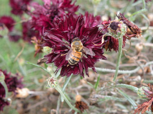
Sunday, November 15, 2009
Removing dam will restore salmon population: MSCNBC
Visit msnbc.com for Breaking News, World News, and News about the Economy
State Representative Lindsley Smith's legislative update in honor of Veterans Day 2009
Legislative Update
From: LINDSLEY SMITH (lindsleysmith@msn.com)
Sent: Sun 11/15/09 8:43 PM
To:
In 1918, at the 11th hour of the 11th day of the 11th month… the world rejoiced. An armistice was signed to end the “war to end all wars.” The following year, President Woodrow Wilson declared November 11th to be recognized as Armistice Day. Some two decades later, Congress voted to make November 11th a national holiday to include all veterans of America’s wars.
To honor the service of military personnel and veterans, the Arkansas House of Representatives, in concurrence with the Senate, enacted several pieces of legislation on their behalf during the 87th General Assembly.
· Act 30 of 2009 requires that all state flags on public buildings be lowered to honor and pay tribute to a member of the armed services, who is killed in action.
· Act 944 of 2009 eliminates the requirement that members of the National Guard or Reserve, who are teachers or school administrators, pay for the cost of a substitute employee when the member is on military leave.
· Act 214 of 2009 amends the Arkansas National Guard tuition incentive program by increasing the annual tuition incentive award up to five thousand dollars per eligible service member payable at $2,500 per semester.
· Act 232 of 2009, clarifies the Governor’s power to order the organized militia into active service for the purpose of working with state agencies in the planning and training for emergencies or disasters and to respond to emergencies or disasters.
Additionally, several pieces of legislation were enacted for special license plates to honor military personnel and veterans.
· Act 784 of 2009 creates a newly redesigned military license plate. The plates will be available beginning November 12, 2009, at Arkansas State Revenue Offices that issue special license plates.
· Act 651 of 2009 authorizes the issuance of a special license plate for Cold War veterans.
· Act 685 of 2009 allows the Department of Finance and Administration to issue Gold Star Family special license plates to spouses or parents of members of the armed forces killed in a conflict.
· Act 632 of 2009 amends the Special License Plate Act of 2005 to allow retired members of the armed forces of the United States to obtain special license plates for nominal fees.
Quilt raffle benefits Fayetteville Public Library
Please click on images to enlarge view of quilt-maker and president of Friends of the Fayetteville Public Library with the ticket that won the beautiful quilt.
Volunteers sold many tickets before the drawing for the quilt. All proceeds go to support the Fayetteville Public Library.

Volunteers sold many tickets before the drawing for the quilt. All proceeds go to support the Fayetteville Public Library.
Saturday, November 14, 2009
Pollinators scarce on the garden around the Fayetteville square on November 14, 2009, because the flowers mostly had been removed to allow for installation of Christmas lights
Please click on image to go to Flick site and Enlarge view of bee and to navigate to view related photos.
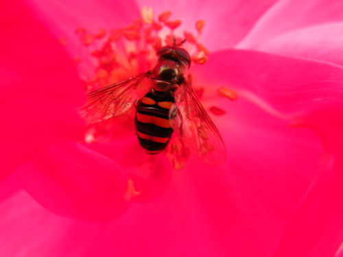
Friday, November 13, 2009
Red Oak Park plan as seen on the official city Web site on November 13, 2009
Please click on image to go to Flickr site ENLARGE view of map from Fayetteville official Web site of the most recent version of Option 2 for so-called "restoration: of Red Oak Park.
Please click on image to go to Flickr site and ENLARGE view of map from Fayetteville official site of the most recent version of Option 2 for so-called "restoration" of Red Oak Park.
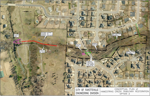
Please click on image to go to Flickr site and ENLARGE view of map from Fayetteville official site of the most recent version of Option 2 for so-called "restoration" of Red Oak Park.
Red Oak Park plan would tear up the ground and displace mature trees and other significant vegetation but do nothing to protect the park from the huge upstream flow of water from the south, east and west
Red Oak Park Plan
MAYBE, this plan would help protect the property of the landowner downstream to the north toward Hamestring Creek. But it will totally miss the point of trying to protect the existing mature trees and will allow an incredible increase in erosion during construction and have only a minimal chance of improving the park in any credible way.
The only worthwhile and effective use of the money set aside for this plan would be KEEPING the water WATER WHERE IT FALLS: On the lots in the subdivisions to the south, east and west in raingardens created in the yards and in the treeless portion of the park at the southeast corner.
Helping people create raingardens using the natural soil remaining in the area and encouraging NOT to mow but to protect native vegetation there would decrease the dangerous runoff to a manageable level.
It is illogical to spend money doing some that won't meet the goals of the people who originally began complaining about the situation.
Fayetteville's engineering and park departments team up to create plan to "restore" channel of stream in Red Oak Park
Please click on image to ENLARGE and go to Flickr site to Enlarge view and to navigate to see related photos.
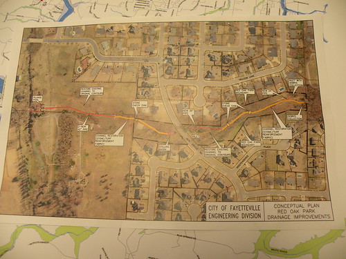
Yellow sulphur butterflies active in Fayetteville, Arkansas, on November 12 and require sustenance. Please don't cut or dig up or pull up or otherwise destroy any existing vegetation
Please click on image to go Flickr site and ENLARGE view of yellow sulphur butterfly.
Thursday, November 12, 2009
Destroying vegetation starves beneficial and beautiful pollinators in November.
Please click on image to go to Flickr site and ENLARGE view of vegetation-free garden and some of the beautiful butterflies that still need flowers in November.
Yellow sulphur butterflies remain active in Fayetteville, Arkansas, on November 12 and require sustenance. Please don't cut or dig up or pull up or otherwise destroy any existing vegetation
Please click on image to move to Flickr site and ENLARGE view of yellow sulphur butterfly and navigate to see related photos.
Wednesday, November 11, 2009
Where have all the flowers gone? Apologies to Pete Seeger, again!
Please click on image to go to Flickr site and ENLARGE view of Pinnacle Prairie on September 10, 2009.
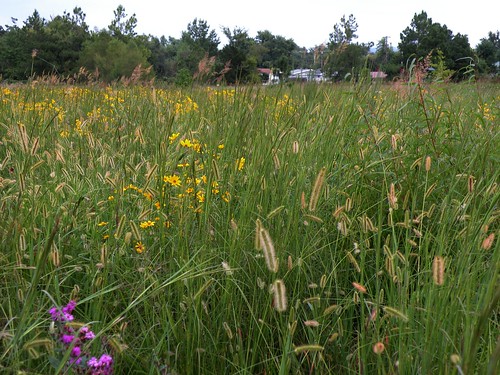
Applebee's restaurants offer free entree to veterans, reservists and active-duty members of military services
Please click on images to go to Flickr site and ENLARGE.

Flag remains at half-staff over Fayetteville National Cemetery on Veterans Day November 11, 2009
Please click on image to go to Flickr site and ENLARGE photo.
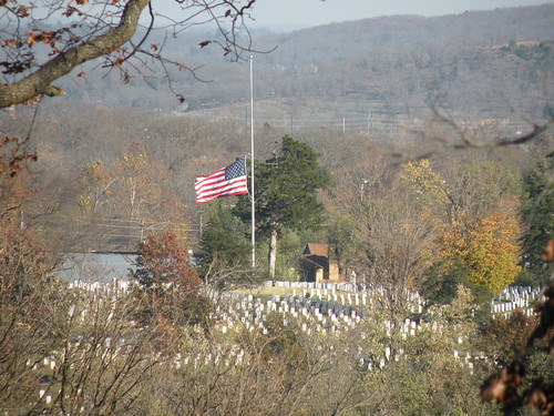

Tuesday, November 10, 2009
Fayetteville's Westside wastewater-treatment plant impresses environmental conservationists with its effective water-cleansing capability
Please click on images to ENLARGE for a better view of environmental conservationists visiting the Westside Water-Treatment site in western Fayetteville, Arkansas, on November 10, 2009.
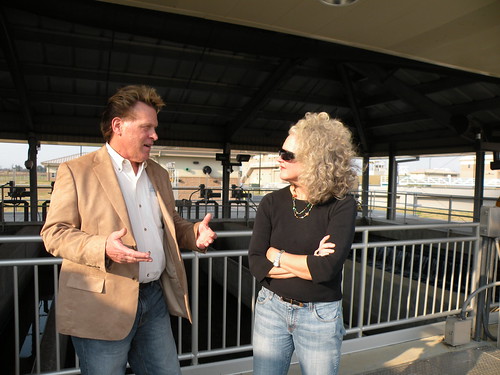
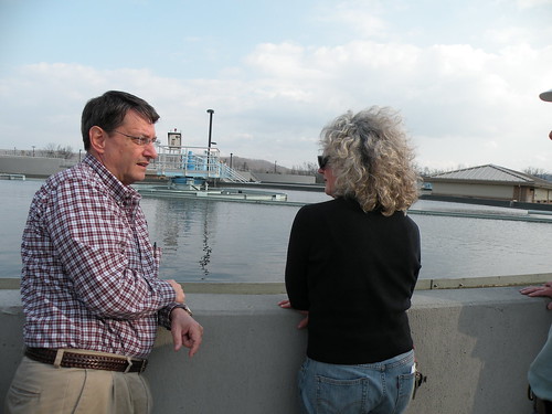
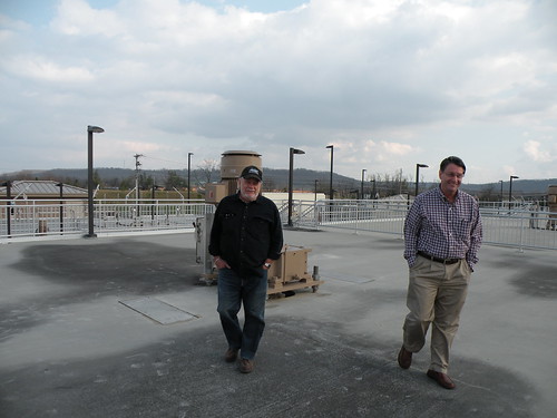
Tour of Woolsey Wet Prairie and Fayetteville's westside sewage-treatment plant at 2 p.m. today precedes big evening for Illinois River Watershed Partnership
Illinois River Watershed Partnership
Annual Stakeholders Meeting
November 10, 2009
2:00 to 3:30 pm Tour of Fayetteville West Side Treatment Plant and Woolsey Wet Prairie
4:00 pm. Tour of Fayetteville Sam's Club
5:30 pm Hors d'oeuvres at Arvest Ballpark, Springdale
6:00 pm Sponsor Recognition and Golden Paddle Awards Reception
7:00 pm. Annual Membership and Board Meeting
Thank you for your dedicated efforts and support
to preserve, protect and restore the Illinois River Watershed.
To see evidence of the need for protection, please click on image to ENLARGE example of construction-site erosion in the Illinois River Watershed.
 |
| From Northwest Arkansas environment central |
Monday, November 9, 2009
Williams grabs cooler and heads to tailgate before Razorback game
Please click on image to go to Flickr site and view winner of Women's 5K at the Fayetteville National Cemetery.

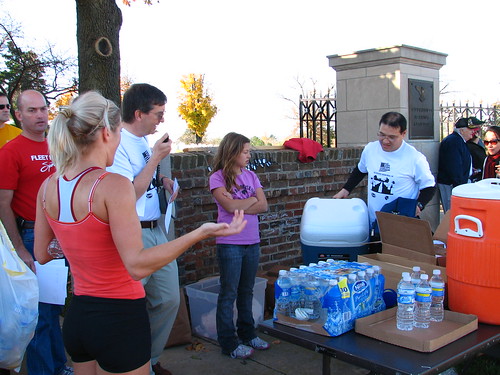

Rendy selected a rolling cooler to take with her to a Razorback tailgate after the race.
Rendy selected a rolling cooler to take with her to a Razorback tailgate after the race.
Subscribe to:
Posts (Atom)


