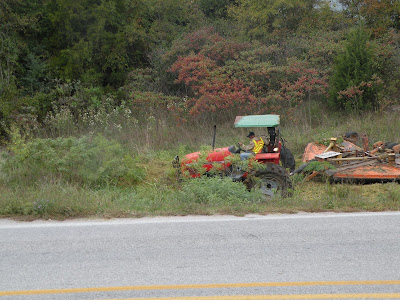
Please click on individual images to ENLARGE. Two hours after these photos were made on October 12, 2010, this area had been brushogged into oblivion. Sure, the swamp milkweed will sprout from its roots next summer. But these plants not only held pods offering hundreds of milkweed seeds but also were feeding milkweed caterpillars that could have made chrysalises and become final 2010 generation monarchs traveling to Mexico and with a chance to return in spring and find fresh milkweed on which a new generation of monarchs could have been raised to keep the cycle of life intact for this seriously threatened species of migrating butterfly. If you want to talk to your Northwest Arkansas representative on the Highway Commission, he is Dick Trammel.
Monarch caterpillars were still eating the foliage of these swamp milkweeds and the seed pods were almost mature when the Arkansas Highway and Transportation Department Mowers came down the road and crushed and cut them off near the ground. Amazing hypocrisy for a state agency that touts its wildflower program. And possibly worse hypocrisy is touting its stormwater-protection work and then mowing and dredging ditches repeatedly every year.
Please click on individual images to ENLARGE view.
To learn more about the Arkansas Highway Commission, please see AHC link.
Please click on images to ENLARGE view of Arkansas Highway and Transportation Department machine digging rich, dark well-vegetated soil out of a ditch on the west side of Arkansas 265 south of Fayetteville. An earlier post quoting a commuting motorist's email contained an error. Washington County is not to blame for this misguided work that threatens to increase the silt load of Cato Springs Branch, the lower Town Branch and the West Fork of the White River entering Beaver Lake. The soil being eroded is typical high-quality prairie topsoil that has washed into the ditch but should be back on farm or pasture or natural prairie land. This soil is hauled away and dumped, allowing more to erode away.


No comments:
Post a Comment